Over three weeks in September, I was fortunate to visit ten islands. The weather at the beginning and end of those weeks was brilliant sunshine. The weather in the middle was less brilliant: lashing gale-force winds laced with cold, Arctic air. That meant my planned itinerary for a ten-day cruise around the Western Isles was not to be. But 'Plan B' was as exciting. The islands we visited on those ten days were Skye, South Rona, Rum, Ulva, Gometra, Inchkenneth, Eileach an Naoimh of the Garvellachs, and Easdale of the Slate Isles.
Prior to the cruise, I spent five days in Largs, hoping for a weather window to get to Little Cumbrae. Fortunately, the weather on the first day was gorgeous, with just a gentle trace of wind. And so, on a sunny Friday morning, my friend Gareth Robinson and I boarded a RIB at the pier in Millport.
I had wanted to return to Little Cumbrae for 16 years. My one (and only) visit to the island had been in May of 2008 when I'd unsuccessfully searched for St Bey's Cell. (See Chapter 2 of 'Firth of Clyde to the Small Isles'.) The 6th (or possibly 9th) Century St Bey came to Little Cumbrae to establish a place of retreat where, to quote from the Calendar of Scottish Saints, ‘she lived in solitude surrounded by birds and beasts.’
Since that visit in 2008, I'd determined what I believe to be the exact location of St Bey's Cell. The site, as described by Historic Scotland in 1964, had "the remains of a rectangular building, 6.0m by 5.0m, its walls turf-covered and 0.4m high. From the appearance of the debris on the east side of the structure, it seems likely that there was a second compartment."
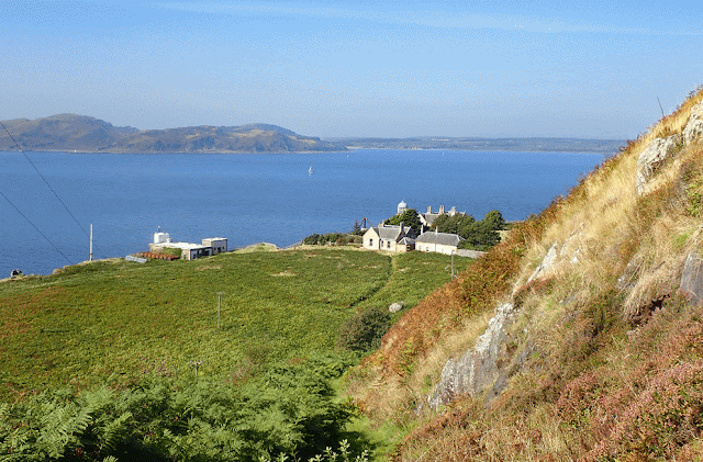
The 'second compartment' may have been St Bey's Cell. As it turned out I had missed it in 2008 by 40 feet. And so, once ashore on Little Cumbrae, Gareth and I followed a path that climbed north from Little Cumbrae House. (The next photo shows Little Cumbrae House seen from the ramparts of Little Cambrae Castle.)
About a third of a mile northwest of the house, at an elevation of 200 feet, we came to a sign that marked the site of St Bey's Chapel. The only remnants of the chapel are the meagre remains of low walls hidden in heavy bracken. St Bey's Cell lay 500 feet to the northwest, across a vast sea of bracken and brambles.
I knew the bracken would be fierce in September, but I had not counted on the brambles. Thick, thorny branches interlacing the tall bracken: as effective a barrier as razor wire on a chain link fence. It made a direct approach to the site impossible. Our only option was to climb to the top of Priest Hoy, the wedge-shaped hill mentioned by William Lytteil in his 'Guide Book to the Cumbraes' (1886). It was a triangular plateau, partially surrounded by a stone wall. Once on top, we followed the wall to a point where the GPS told us we were above the site of the cell.
Below us, about 100 feet to the west, lay an oval patch of yellow-green grass surrounded by a jungle of bracken. On its far side was the burial cist (CANMORE ID 40690) I'd seen on my last visit, cloaked in heavy grass. On the near side lay the site of the cell. But if there were any remaining ruins, they, too, were not visible.
We walked north to a break in the wall, took a deep breath, and descended into a bracken and bramble hell. Guided by the GPS, we started making our way to the location of the cell. Progress was glacially slow, and after fifteen agonizing minutes, a look at the GPS told me we were still 60 feet from the site of St Bey's Cell.
We tried to carry on, but it was not to be. My legs and arms were getting severely scratched, the thorns ripping through my pants and cutting into sore thighs. In addition to the thorns, clusters of nettles were lurking in the weeds. Occasionally, a nettle would stab its way up the insides of my pant legs, leaving stings that would last for hours. (I forgot to bring gaiters.) After another few minutes of thrashing about, yet another obstacle appeared. The ground was getting marshy; boots sinking nearly a foot with every step into a soupy morass. Finally, after making only another 10 feet of forward progress, we gave up. To find the site of the cell I'd have to return, yet again, in early springtime, before the bracken went wild.
A painful and disappointing backtrack led to the top of Priest Hoy, from where we descended to Little Cumbrae House. We still had a couple of hours to explore, so we decided to walk across the island to visit the 1757 coal-burning light tower at the summit, and then descend to the western shore to see the 1794 lighthouse that replaced it.
Under blazing sunshine, we climbed the lighthouse path to where it crested a rise, marked on old maps as 'Rest and be Thankful'. (We did rest and were thankful.) As we traversed the island, hoping to reach the summit, we were, again, thwarted by the bracken. There was no visible path to the top, and we'd had far too much bracken bashing for one day. (The next photo, taken in May of 2008, is of the 1757 light tower.)
Although there was no practicable way to reach the summit, the path to the west light was clear and easy. Fifteen minutes later, after downing a couple bottles of Peroni, we started the descent to the lighthouse.
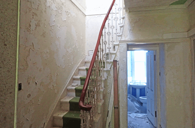
Several of the abandoned buildings were open. We explored the interiors, finding signs that people had camped in them. The highlight was the ascent to the lantern room of the 1794 lighthouse.
The original lamps of the lighthouse were replaced by Argand lamps in 1826, and in 1865 a foghorn was installed - the first in Britain. The tower was restored in 1956, and a solar-powered light was installed in 1974. The light was extinguished for good in 1997 when a 36-foot-tall automatic light tower was built adjacent to the old generator house.
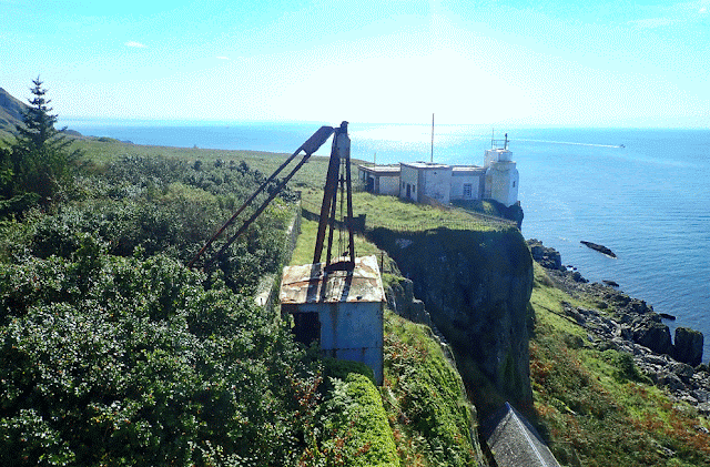
From the balcony of the lantern room, we could see down to the slipways and the tram track used to bring supplies ashore.
An hour later we were back on the RIB, jetting across the sea to Millport. For a description of life at the Little Cumbrae Lighthouse in the early 1960s see this link: https://www.lighthousedigest.com/Digest/StoryPage.cfm?StoryKey=2302


