Wednesday, August 31, 2016

Tom Ni Bharabhais

I am intrigued by the beehive cells of the Hebrides, and whenever I'm in the islands I make a point of seeking them out. Most of the cells that are near roads have been pillaged for stone, but walk a ways off the road and dozens (if not a hundred) intact, and nearly intact cells, are lying out there waiting to be found.

A few weeks ago I made two excursions in the Lewis hinterlands in search of beehive cells. One of those started at Tom Ni Bharabhais, the knoll of the Barvas Cattle, which lies just 300 yards off the B8022 road to Uig (Lewis), a mile before it crosses the Morsgail River.

Cairn on Tom Ni Bharabhais
If you drive this road to Uig you can't miss Tom Ni Bharabhais, for atop it stands a tall, slender cairn, easily seen from the road; a cairn made of stones robbed from two beehive cells that once crowned the hill. Here is the history of the cairn, as recounted by Alasdair Alpin Macgregor, in The Haunted Isles (chapter 2, The Road to Uig):

The cairn marks the spot upon which was decided the last encounter in the feud that for centuries distracted the MacAuleys of Uig and the Morrisons of Ness from peaceful pursuits. Two or three hundred years ago the Morrisons, in an attempt to recover a herd of cattle that the men of Uig had driven off from Barvas, set out from Ness for the territory of the MacAuleys, and overtook the cattle-rievers in the vicinity of this hillock. There, according to tradition current in Uig, the Morrisons suffered severe defeat at the hands of the MacAuleys.'

Tom Ni Bharabhais - beehive ruin behind to the right
These days they would not destroy beehive cells to create a cairn, but attitudes were different two hundred years ago. In the photo above you can just make out the meager remnants of one of the cells behind, and to the right, of the cairn.

Although these two beehive ruins are totally unremarkable, the country to the southeast of Tom Ni Bharabhais is full of cells, some completely intact. And so from Tom Ni Bharabhais I made a long circular walk to the south and east around Loch a' Sguair, visiting a half-dozen shieling sites with beehive cells. Here are two examples of what I found.

Beehive at Airigh a' Sguir - 1

Beehive at Airigh a' Sguir - 2
If these ancient dwelling fascinate, then put on a pair of good boots, get yourself to Uig, and head for the hills and lochs. I can almost guarantee you won't see another soul. Your mobile phone may not get a signal, so before setting out be sure someone knows your plans. Also be sure to wear gaiters, for there are hungry ticks out there waiting for a savory snack to pass by.

Tuesday, August 30, 2016

Sandaig - Ring of Bright Water - Camusfearna

In the November 29, 2015 post I mentioned that my first exposure to Gaelic, and the Hebrides, was in 1969, when my mother took me to see the movie Ring of Bright Water. Many years would pass before I actually read the books of Gavin Maxwell and, many years after that, the three fascinating books about him: The White Island by John-Lister Kaye, Maxwell's Ghost by Richard Frere, and the recently published Island of Dreams by Dan Boothby.   

After re-reading the Bright Water books a few years ago I became obsessed with the idea of visiting the lighthouse island of Eilean Ban, and Sandaig (Maxwell's Camusferna), his house that tragically burned in 1968, killing the otter Edal. Eilean Ban was easy to get to, sitting (somewhat sadly) under the Skye Bridge, and I paid it a visit a few years ago (see the July 18, 2013 post). But Sandaig takes some planning to see. It is fairly remote, a few miles south of the Glenelg ferry to Skye. And so after many years of thinking about it I decided to visit Sandaig on my way to the Western Isles a few weeks ago. Before taking the ferry from Uig out to Harris, my wife and I stayed for a couple of nights at the Tingle Creek Hotel in Erbusaig, a mile or so from the Skye Bridge.

From Erbusaig I set out for the 30 mile drive to Glenelg via Shiel Bridge and the Mam Ratagan Pass. From Glenelg I continued south along the single track for another four miles, parking at the start of a forestry road that led down to the sea.

Start of the track to Sandaig
Any doubt you are in the right spot is helpfully resolved thanks to a sign that says "Ceum Sanndaig - Sandaig Path."

Sandaig - this way
I had directions on how to walk down to Sandaig that I found on the Eilean Ban website. But, as I quickly learned, they were obsolete due to all the timber harvesting on the hillside. And so I just carried on along dusty forest roads that led down to the sea. Maxwell would be saddened with how the area above his beloved bay looks, the trees have been clear-cut and it's an ugly mess.

Clear-cut fields above Sandaig

Once through the devastated hillside you drop down to the still beautiful bay of Sandaig.

Sandaig
The spot where Maxwell's house stood is marked by a large stone. On it is a plaque that reads:

Beneath this stone,
the site of Camusfearna,
are buried the ashes of
GAVIN MAXWELL
b. 15th July 1914, d. 7th September 1969

Memorial Stone -1
Memorial Stone -2
Memorial Stone -3
Under a large tree near the Sandaig burn is another memorial stone that marks where the otter Edal is buried. It reads:

EDAL
THE OTTER OF RING OF BRIGHT WATER
1958-1968
Whatever joy she gave to you, give
back to nature.    GAVIN MAXWELL

Edal's Stone - 1
Edal's Stone - 2
Next to Edal's stone the bright water of the Sandaig burn ran to the sea; an interesting rope bridge spanning the stream. (One walk description I've read says that if you're brave enough to cross the bridge (or ford the river), you can find an alternate way back up the hillside.) After spending a while in this peaceful place, touched by a man whose legacy of books will be immortal, I started back up the hill.

The rope bridge across the bright water of the Sandaig burn
Back at the car I decided to visit the original Sandaig lighthouse. It once stood on Eilean Mor, an island just offshore from Maxwell's house. In 2004 it was replaced by a solar-powered light, and the original moved to the Glenelg ferry. After looking in the mini-lighthouse (which is now a tourist shop) I drove onto the Glenelg turn-table ferry to go over the sea to Skye.

Old Sandaig light at Glenelg ferry
The turn-table ferry to Skye
If you are interested in visiting Sandaig, good directions can be found on the Walk Highlands website.

Wednesday, August 24, 2016

Kyles Stulaigh - and more

After visiting the Stone of Sorrow, I made my way 250 yards northeast to a souterrain known as Tigh nan Leacach (the house of flagstones). There are the ruins of three circular cells here, and at the base of one is a passage that extends 33 feet underground. But its entrance is so clogged that there is no way to crawl into it these days. (See this CANMORE page for more on Tigh nan Leacach.)

Entrance to Tigh nan Leacach
The plan from this point on for my two-day trek was to carry on another mile through Bealeach a' Chaolais (the pass of the the narrows), to reach an abandoned settlement on the coast, Kyles Stulaigh. Then I'd spend the night there before returning to Lochboisdale the way I'd come. I had picked this destination because Kyles Stulaigh was briefly touched by history 270 years ago.

It was not an easy mile through Bealeach a' Chaolais. There is no trail, and the steep descent to the coast was through thick bracken and heather. At one point I had to get through a gate in a deer fence; a gate securely tied with about a hundred feet of knotted rope, and jammed shut with pieces of timber. It would take a knife and a saw to open the gate, so I tossed my pack across the fence and climbed over.

The 'locked' gate
From the gate another stretch of heather- and bracken-bashing took me down to Kyles Stulaigh. Just offshore lay the island of Stulaigh.

Kyles Stulaigh - Stulaigh Isle in the distance
Kyles Stulaigh, an abandoned township with the ruins of about four blackhouses, was occupied as late as 1911 - see this CANMORE page for more on the township. This small, remote settlement, was touched by history for a day in 1746.

After the loss at Culloden in April of 1746, Prince Charles went into hiding, spending nearly 10 weeks, from April 20 through July 4, in the islands. Those 10 weeks were hectic. Ever on the run, he moved from place to place, his only respite a three-week stretch at Corradale, five miles north of Kyles Stulaigh. (See the March 14, 2014 post for the description of a visit to Corradale.)

The prince left Corradale on June 6, and headed north to Wiay island. But a week later he was heading back south past Corradale to spend the night of June 14 at Kyles Stulaigh. To get a feel for how hectic his travels were, below is an extract from The Itinerary of Prince Charles Edward Stuart, by Walter Biggar Blaikie (1897). You can find a PDF of the Itinerary here - pages 34 to 36 cover his time on South Uist.

MAY 15 – JUNE 5: At Coradale in a forester’s cottage. Here the Prince remained for twenty-two days in comparative comfort and safety; he was visited by his friends and enjoyed shootings at which he was very expert. Learning that troops had landed in the Long Island and were hemming him in, he was obliged to move.

JUNE 6: Sailed to Island Ouia (Ord. Sur. Wiay).

JUNE 7-9: Remained at Ouia where they heard the troops were following them.

JUNE 10-12: The Prince and O’Neil went to Rossinish by land, and remained three days, until they learned that the boats of the militia were patrolling the place. Donald Macleod and O’Sullivan, hearing of this came in a boat, brought them away and steered for Coradale.

JUNE 13. Forced by storm to put in at Uishness Point, they spent the night at Aikersideallach (Ord. Sur. Acarseid Fhalaich) in the cleft of a rock.

JUNE 14. The enemy being within two miles of them they sailed to Ciliestiella (Ord. Sur. Kyle Stuley).

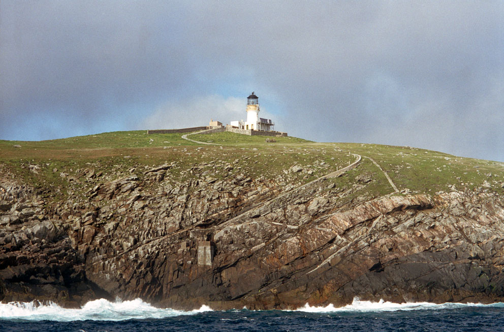
Kyles Stulaigh lay in a beautiful, sheltered nook on the coast, and to the north I could see Corradale, and farther off the lighthouse at Uisinis (see the October 3, 2015 post). Kyles would be a great place to spend the night, but being sheltered from the wind meant the midges were thick. And if I stayed here I would have to return the way I'd came. The thought of climbing back up the rough hillside was not appealing, neither was spending the night in midge-land. So I looked at the map and made a quick decision to return to Lochboisdale by following the coast to the south.


When the prince left Kyles Stulaigh he sailed south along the coast I was now following. Going by boat he probably had an easier journey than I did, as the coast consists of a series of lumpy headlands covered with bracken and heather. Deer trails made the going easier. Without them it would have taken twice as long. 

Deer trails through the bracken
I had to go inland three times to get across the heads of narrow ravines cut deep by peaty streams. The prince sheltered at the outlet of one of these streams on his way to Lochboisdale, but I don't know which one.

A ravine to cross
A sheltered inlet on the coast
Aside from thick bracken and ravines, there was a man-made obstacle at one point. Yet another deer fence, this one with neither a gate nor a stile. So I had to toss the pack over and climb it.

Up and over
The coastline seemed endless, but the views east were amazing. At one point I came across a baby seal snoozing on a boulder.

The lumpy coastline
Baby on the rocks
It was starting to get dark when I finally came to where the coast turned west at the mouth of Lochboisdale. As I was setting up camp Lord of the Isles, the ferry from Mallaig, came steaming by.

Lord of the Isles arriving from Mallaig
Campsite at the mouth of Lochboisdale

During the day's hike I had managed to eat most of my food. So after pitching the tent all I had left to eat was a bag of crisps and a red-tinny of Export. But it was refreshing after a long day of hiking.

The night was windy, which kept the midges away, and I slept well. A little after 7am I was woken by the loud chugging of an engine; the culprit was the ferry on its way back to Mallaig.

Morning ferry to Mallaig
Breaking camp was quick, and I was soon on the homestretch to Lochboisdale. After rounding one last ridge the big marina came in sight, and a few minutes later I could see the Lochboisdale Hotel, where my wife was probably still comfortably sleeping. Soon after passing Cladh Choinnich, an old burial ground and chapel site, the bridge at Aurotote came into view.


Lochboisdale Marina
Lochboisdale
An hour later I was soaking in a hot tub, and in the afternoon we went for fish & chips at the Politician Pub down on Eriskay: a great way to end a two-day trek to see an historic, and rarely visited corner of the Hebrides.

Friday, August 19, 2016

Carragh Broin - The Stone of Sorrow

When I was on South Uist this week I made a two-day-trek around Beinn Ruigh Choinnich (the hill of Kenneth’s shieling). With a tent, sleeping bag, and midge net (among other things) strapped to my back, I crossed the footbridge at Auratote (NF 787 205). From there a soggy footpath led up to the reservoir of Loch nan Smalag (loch of the coal-fish), the water supply for Lochboisdale.

Footbridge at Auratote
From the loch I started across the boggy moorland to the northeast. To my right lay Beinn Ruigh Choinnich and the triple heights of Triuirebheinn (the hill of three peaks). Once around the shoulder of Triuirebheinn I climbed Bealach na Doillaid, the pass of the saddle. From the top of the pass I could see Loch nan Airm (the loch of weapons) lurking in a crater at the bottom of the slopes.

It was slow going down the trackless, bracken and heather clogged hillside to the Loch of Weapons. On the way down I met a shepherd out gathering sheep, on what was the first day of decent weather in over a week. Once down at the loch I made my way to its southeast corner. Hidden under the bracken here is a squat, rectangular boulder; marked on the map as 'Carragh Bròin' (the stone of sorrow). 


Some descriptions of the Stone of Sorrow say it's a standing stone. But there are no standing stones in the area, and this is the only substantial stone anywhere near the location marked on the map. As I made my way to the stone I nearly took a fall, tripped up by a run of rusty fence wire hidden under the bracken. It was a close call. Then, wanting to take a photo of the stone, I started pulling out some of the bracken that hid it. In doing so a sharp frond of bracken slashed open my index finger. The blood was flowing, and of course, my first-aid kit was buried at the bottom of my pack. The Stone of Sorrow was certainly causing me some sorrow.

Looking across Loch Nan Airm from the Stone of Sorrow - Loch Stulabhal in distance
Stone of Sorrow under the bracken
The story of the stone’s name, and that of the loch, is in Otta Swire’s The Outer Hebrides and their Legends (chapter 7). In it she recounts the tradition that the last battle between the Vikings and the people of South Uist occurred here. The battle was indecisive, and both sides stopped fighting. The wounded where brought to the stone, and the combatants threw their weapons into the water as a sign of peace.

Another version of the stone’s name is in DDCP Mould's West Over Sea (chapter 8). This one is not so dramatic. It says a duel was fought here, and that one of the contestants, after being wounded, collapsed on the stone.

After taking a few photos of the stone I carried on to the east. My next stop, Tigh Leacach, a large souterrain on the hillside above the loch. Then I planned to carry on through Bealach a' Chaolais to spend the night in the old settlement of Kyles Stuley, one of Prince Charlie's hideouts in 1746.

To be continued...

Carragh Broin - The Stone of Sorrow

Wednesday, August 10, 2016

Flannan Attempt - And a Disaster

Heavy swell precluded getting out to the Flannans today. So the MV Lochlann, operated by SeaTrek, took us on a tour around many of the islands in Loch Roag. But before doing that we motored up to Dalmore to see the oil rig, Transocean Winner, that broke lose from its tow cables during the storm that blasted through the Western Islands a few days ago. It was bound for Malta, but may end up being a tourist attraction, of sorts, one that Dalmore does not need. 

Tuesday, August 2, 2016

Flannan Attempt

I will be island-going for a couple weeks. During that time I hope to get out to Eilean Mor of the Flannans. Of five attempts to get there over the last 16 years, only one was successful. That was back in 2003, and I've wanted to return ever since.

This attempt will be with Seatrek on August 10. They operate out of Miavaig on the west of Lewis, and if you are reading this before then there may still be places available. The weather forecast is a bit dismal, but maybe we'll be lucky and get out there. Since the Flannans feature in Peter May's excellent mystery 'Coffin Road', I have a feeling there may be more day trips on offer in the future. (Hopefully I won't find anything grisly in the chapel, and then wash ashore on Luskentye not knowing who I am...)

West Landing - Eilean Mor of the Flannan Isles