Showing posts with label Rum. Show all posts

Tuesday, April 8, 2025

Hylle-fjell—Hallival—The Mountain of Ledges—Rùm

In May I will be staying the better part of a week on Rùm. Over the past decade, I've made several day trips to the island, but it's been 25 years since I've stayed there. My wife and I spent a week in 1997 and again in 2000. On both occasions, we had accommodations on the top floor of Kinloch Castle. Those rooms have not been used for 20 years, as the castle is fenced off and mouldering away. In going through my journals from back then, I realised I'd not written much about one of the walks I made in 2000.

* * *

It was June of 2000, and my wife and I had walked the five miles to Kilmory at the north tip of Rùm. In the Kilmory burial ground lies an ancient, cross-carved pillar stone I wanted to see. There is also another stone, one that marks the grave of the Matheson children. Murdoch Matheson had been the Kilmory shepherd from 1855 to 1875. As of September 7, 1873, the Mathesons had eleven children. Over the next three days, they lost five to diphtheria. Grief-stricken, they emigrated to New Zealand. The children’s tombstone, inscribed with all those young names, is a grim reminder of island life a century ago. 

But, when we reached Kilmory, we were told we could not enter the burial ground. A hind was about to give birth, and a battalion of walkie-talkie and binocular-toting naturalists monitored the blessed event as if it was a virgin birth. There was still a lot of daylight left, so when we returned to the cross-island track, I abandoned my wife (something she’s used to). If I hurried, there was just enough time before dark to get high. The mantled peak of Hallival was calling.

Getting to Hallival required climbing into Corrie Dubh, the Dark Corrie. It was an easy walk at first, along the banks of Allt Slugan a’ Choilich to the dam and powerhouse that supply electricity to the castle. Then the path left the forest, which was good and bad—I was baking in the sun, but there were no midges. Over the next half mile, the path climbed 600 feet to another dam. There was no rest for the weary on this damn path. It insisted on continuing its relentless ascent to yet another dam at the 900-foot level.

I was now in Corrie Dubh, where the headwaters of Allt Slugan a’ Choilich come together. The terrain near here was the site of some botanical skulduggery a half-century before. It was where Professor John Heslop Harrison of Newcastle University was accused of planting Carex Bicolor, a species of sedge never before seen in Britain.

The professor wanted to prove a theory that some plants and insects survived the last Ice Age in Britain. To do this required two things. The first was to go to a place that had remained ice-free throughout the last Ice Age. Mountain tops above ice fields are known as nunataks; Hallival is one example. The second thing Harrison needed to do was find species in such a location that did not exist nearby, meaning they could not have naturally spread there after the ice receded. One such candidate was Carex Bicolor, a perennial sedge that grows to a height of five inches and is not native to Britain.

The Professor was fortunate to be allowed access to Rùm. This was during the 1940s and 50s, when it was known as The Forbidden Island, and you needed permission to land. The professor was acquainted with the Bulloughs, who allowed him to lodge in the castle. That made Rùm, in a sense, his own private island for botanical research.

Karl Sabbagh’s A Rum Affair, published in 1999, tells the story of John Raven, a classical scholar and amateur botanist, who investigated the suspected planting of alien species on Rùm (and elsewhere) by Professor Harrison. As the following extract from John Raven by His Friends (privately published after his death) shows, Raven was the ideal person to investigate the allegations.

Anyone who boatanized with John on mountains soon came to realise that he had an instinct for a ‘good’ site and would often go unerringly to the place where the rare plant was going. This was partly because he used, almost subconsciously, signs of ‘indicator species’—commoner mountain plants which were sufficiently choosy about where they grew to mark off the site as worth searching for the real rarities—but also, one had to admit, he seemed to have an inexplicable skill in prediction. When this was combined, as it so often was, with his capacity for very painstaking detective work, the combination was very powerful indeed.

John Raven passed away in 1980. His obituary included the following: In 1954 he was at the centre of a curious episode. A reputable biologist had recorded finding, on the isle of Rum, several plants not previously found in Britain. The botanical world was surprised, not to say suspicious, John went to investigate. His report was deposited in the Trinity College Library and has never been published.

To quote from A Rum Affair: At the heart of [Raven’s] report was an accusation that Professor John Heslop Harrison of Newcastle University had, at some time in the 1940s, transported alien plants to the island of Rum and planted them himself in the soil. He had then, Raven alleged, “discovered” the plants and claimed that they were indigenous to the area and that he was the first to come across them.

Raven would go on to co-author the classic Mountain Flowers, published by Collins in 1956, and to write A Botanist’s Garden in 1971. Although A Rum Affair was published the year before my walk, I had not read it. And so, as I passed through Corrie Dubh, I had no idea it played a starring role in the affair. Even if I had known, I was exhausted and would not have gone ‘off piste’ to search for where a professor surreptitiously planted sedges. I was intent on summiting Hallival, the mountain of ledges.

From the head of Corie Dubh, the path ascended another 600 feet to Bealach Bairc-mheall. Climbers have a choice here. A turn to the right led to the summit of Barkeval, while a left turn was the start of the Cuillin Traverse, a ten-hour excursion starting with Hallival that bags seven peaks. The summit of Hallival was a mile away, and the final ascent required climbing a giant staircase of gabbro ledges.

Many of the ledges were carpeted with grassy tufts known as shearwater greens, fertilised by the copious quantity of guano produced by the Manx shearwaters that nest there.

The rocky mantle was a vertical maze, a puzzle that needed to be solved to reach the top. The sun had been relentless all day, and after hiking over a dozen miles, I was baked, burned, and running out of steam. But the exhaustion evaporated as, with a shout of joy, I boosted myself over the final ledge. The triangular plateau looked like an altar to the sky. The views were spectacular and vastly different from 250 centuries ago when the summit was an island in a sea of ice. As all that ice receded, it left behind something beautiful.

To the north, the forest enveloping the castle created a green oasis at the heart of Kinloch Glen, backed by the Cuillins of Skye on the far horizon. 

The view south was as inspiring, where the knife ridge to Askival tempted further wanderings. To attain its summit would require dropping 400 feet to the saddle, then ascending 700 feet to Askival’s airy top. Another temptation was to spend the night on the ledges of Hallival to witness the shearwaters’ return. I had to resist both. It was getting late, and the wife would worry if I was not back before dark.

* * *

Later that evening, Clive Hollingworth, the castle manager, offered us a tour. One stop was Monica Bullough’s ornate bathroom, with its over-the-top shower: spigots and sprays that can reach every hidden nook and cranny. It surpassed any of the ‘Rainforest Showers’ in upscale hotels. Then, after a visit to the Main Hall, Clive led us to a closet that housed the orchestrion. Built in 1900, it was produced by Imhof and Mukle, a company based in the Black Forest. It was one of the largest orchestrions made and was driven by a wooden roll with eighty-eight tracks for notes and twenty-two tracks for organ registers and percussion. The sound blasted from 264 pipes, with registers that produced clarinet, piccolo, flute, trumpet, and trombone sounds. The bellows were powered up, which blew air into an intricate mechanism that ran the keys and percussion controls. The resulting symphony was astonishing. It echoed through the Great Hall, echoing the extravagant sounds of a privileged past.

The next stop was the ballroom, which Clive called the ‘orgy room.’ It had worn silk wall hangings that once provided an erotic ambience, amplified by a constellation of stars on the ceiling. When the lights were dimmed, they gave the party-goers the feeling they were out under the stars. It was the perfect place for free love. The windows were high on the walls so no one could spy on the merrymakers. And if those merry-makers were thirsty, a revolving bar prevented the help from seeing the goings-on. If the Rùmachs want to revitalise their economy, they should consider restoring the orgy room and offering it out for nightly rentals.

Saturday, December 28, 2024

Rum and Dutchman's Cap

After a night at anchor off Hallaig, we set a course south to transit under the Skye Bridge. That gave me a brief look at two historic sites. To port was the Eilean Ban lighthouse and cottages, made famous by Gavin Maxwell. To starboard was a lesser-known historic site, the Chain Stone of Skye. This stretch of sea has been a strategic choke point for thousands of years, as the inside passage is far easier than the long journey through the exposed waters west of Skye. When the bridge opened, there was quite a furore over the tolls. But it was not the first time tolls were collected. Centuries ago, it must have been an interesting sight when a 1000-foot-long barrier of chained logs stretched across the channel: one end securely fastened to Eilean Bàn, the other to the Chain Stone on the Skye shore.


Once through the Sound of Slate, we headed west to find an overnight anchorage in Loch Scresort of Rum. We had a few hours of shore leave before supper, so we went for a wander. Sally met up with the warden to talk ponies, and I took Debbie for the two-mile nature walk that follows an old road up the north side of Kinloch Glen. We returned to the ship after tea and a beer at the shop - I'll let you guess who had the beer. On the way back, we passed the sadly decaying Kinloch Castle. Such a waste.


We departed Loch Scresort the following morning on a quest to an island I'd wanted to visit for decades and one that Debbie also had a keen desire to see: Bac Mòr, better known as Dutchman's Cap. I first noticed the Dutchman in 1989 while on a Turas Mara day trip to Lunga. After climbing to the summit of Lunga, I saw an odd-looking island two miles to the south. It was a plug, a big hump rising out of the sea, a nearly 300-foot volcanic cone atop a grass-grown plateau of dark stone. 

The island’s Gaelic name is a mix of Norse and Gaelic; Bac, Norse for ‘hump,’ and Mòr, Gaelic for big. Seen from afar, this 'big hump' looks more like a Mexican sombrero than a Dutchman’s cap. The name may have stemmed from Dutch fishermen being the first to fish in the area commercially. But Donald MacCulloch, in his book Staffa, suggests that ‘Dutchman’ may be a corruption of Doideag, Gaelic for a witch, which is a possibility, as the island's profile could be compared to that of a witch’s hat, although not as pointy as the one worn by Elphaba, the Wicked Witch of the West.

I have long wanted to set foot on Dutchman’s Cap. The main attraction was not its distinctive geology but the remains of three circular dwellings. Could they be beehive cells? Maybe, maybe not. There is also an enclosure 100 feet in diameter surrounding them—similar to a cashel. Cattle were once grazed on the island, so the enclosure and the dwellings may have been built for that purpose. But, just perhaps, they were built long ago for use as an island hermitage, as Iona lies only seven sea miles away.

Landing on the Dutchman is only possible when the tide is low and the sea is calm at a shelving ledge on the island’s east side. Approaching that spot can be dangerous. The surrounding sea is a minefield of skerries and, in places, only three feet deep at mean tide. The largest skerry is Sgeir Blàr nan Each, the skerry of the field of the horse. It is an odd name for a reef barely spanning 200 square feet at low tide. It’s hard to imagine someone putting a horse on that sea-washed reef, but that’s the name the surveyors recorded in the OS Name Book in 1878. However, on an 1859 coastal chart, it's named Sgeir Bhàirneach, barnacle skerry—which sounds like a more probable name.

After a three-hour sail, we approached the eastern side of the Dutchman. Strong winds had blown all day, and a six-foot swell lashed against the cliff-girt shore of the island. It was readily apparent we’d not be able to land. That was a disappointment, one I’ve gotten used to over the years. The engines were throttled back to give us a long look at the island. The enclosure and old dwellings are set back from the lip of the table rock and are not visible from the sea. What was visible was the massive hump that gave the island its name; stair-stepping terraces of turf encircled its lower half, a sign that grazing sheep have been here in the past. The upper half of the hump was a basaltic mantle crowned by a cylindrical trig-pillar. (The settlement site is marked with an 'x' in the following photo.

In his book Coll & Tiree (1903), Erskine Beveridge briefly mentions the Dutchman: Upon its east shoulder, below the prominent 'Cap,' the ruins of three small circular erections—probably old shielings. Bac Mor is now tenanted only by Highland cattle, as to which a local saying runs that nineteen will thrive upon this island, but twenty would starve—surely a most precise computation!

We occasionally saw the landing ledge where, per Erskine Beveridge, cattle were once set ashore. Our sightings of the ledge were brief because the rolling sea repeatedly washed over it. Even if the sea is calm, there is no place to anchor, so the chances of landing are always slim. In Islands by the Score, Alasdair Alpin MacGregor commented as follows on the suggestion that the ruins on the Dutchman were shielings:  Could these be the ruins of summer shieling visited by the Lunga folk in olden times, as has been suggested? What would seem to render this unlikely is the fact that, even on the calmest days, it would be impossible either to land cows, alive, on this island, or to get them off, alive, at the end of shieling-time.

As for MacGregor’s comment that it would be impossible to land cattle on the island, per Erskine Beverage, as many as nineteen were pastured there. But the sea state we witnessed on that September day would make it impossible to land people, let alone cattle. A landing on the Dutchman would have to wait for another time. A private charter out of Tobermory or Ulva Ferry would be the best way—an adventure for the future.

Before leaving, we passed the skerry of two names: Sgeir Blàr nan Each/Sgeir Bhàirneach. There were no horses on the reef, and if there were any barnacles they were covered by the roiling surf. We also took a look at Bac Beag (on the left in the next photo). Bac Beag is the 'little hump', which at low tide is connected to the Dutchman. This little hump is actually humpless—a flat table of basalt rising fifty feet above the sea.

Leaving the Dutchman in our wake, we set a course for the shelter of Lon Bhearnuis, a bay on the north coast of Ulva. 

After settling into the bunk that night, I set the alarm for 3 a.m. When it sounded, I was hesitant to abandon the warm bed. But then I remembered that the heavens were calling. Trying not to wake anyone, I went up on deck as quietly as possible. It was a clear night, the hills of Mull and Ulva glimmering under the light of a full moon. Several others joined me from the ship’s company, and together, we watched the moon dim as Dubhadh Gealaich, the lunar eclipse, began.

Saturday, June 24, 2023

A Shot of Rum

Two weeks ago I had a few hours of shore leave on Rum. Not enough time to do much. But time enough to do something exciting. After passing in front of the sad-looking and fenced-off Kinloch Castle, I made my way to the bridge over the Kinloch River. Once over the bridge, a turn to the left led to the start of the North Nature Trail. A thousand feet later, at an elevation of 100 feet, the trail made a hard left turn to the west. It was time to leave the easy track and dive into the hard wilderness.

Hard wilderness may seem an exaggeration. But it was hard, it was wild, with seemingly endless stretches of three-foot-tall hummocks of grass. Each hummock hid one of three things: a deep hole, a patch of swamp, or a stream. It was slow going, made easier now and then by deer trails. How in the hell deer ran along these paths without plunging into a hole and breaking a leg is a mystery.

It was a swelteringly hot day. Whenever I stopped to cool off the midges and clegs showed up in force, so the respites were short. The despairing challenge of the hummocks was interspersed with sections of blessedly shaded woodland. But it was not much of a blessing, as it required multiple detours around impassable swaths of trees. Here and there dead stumps rose from the ground. Whenever I grabbed one for support it crumbled to dust. Dead and dried. I felt dead and dried. I was also worried about ticks, so avoided sitting on the ground to rest, as I ascended eastward across the shoulder of Meall a’ Ghoirtein.

A half-hour later, I reached the tree line at an elevation of 300 feet. The GPS indicated I had another 200 feet to climb and a quarter mile of terrain to cross to reach my destination. Twenty minutes later I noticed a structure built upon a strange, arch-shaped boulder. The boulder was ten feet by five, and the structure was what I’d been searching for: an intact beehive cell, eight feet high at its centre.


There are nearly 400 shieling huts on Rum, and over a hundred of them were circular cells. Only about three of the beehive type are still intact, and this cell, high on the slopes above Kinloch Castle, is one of them. It was a stunning location, with a wide view over the mouth of Loch Scresort. Most of Eigg could also be seen, with the high prow of An Sgùrr pointing skyward.

There was a low, lintelled entrance on the east side of the cell. Ticks be damned, I crawled inside. The interior was blissfully cool, and mysteriously shielded from the barrage of persistent midges. The dome was not perfectly built, and several gaps allowed shafts of sunlight to illuminate the interior.

The floor was covered with a thick layer of dried thatch, which would make it a comfortable place to nap. Large, flat stones lay under the thatch; stones that strangely clanked when any pressure was applied, hinting that there may be storage chambers below them. I was beat in the heat and had limited time, so was not in the mood to nap or look under the stones.

The cell was once part of a shieling village, and the ruins of several other structures dotted the nearby hillside. It seemed like an odd place for shielings, on the steeply sloping ground below Meall a’ Ghoirtein. But the hill’s name hints at why the settlement was here, as it roughly translates to the Hill of Cultivation (OS Name Book, Argyll Vol. 63, p.67). It was a beautiful spot, with an open view over Loch Scresort. The loch was as calm as a mill pond, and along with several sailing yachts I could see our ship, Hjalmar Bjorge, lying at anchor. 

The reinforcements the midges had called for then showed up in force. It was time to "run away, run away". On the way back to the pier I wandered around the fenced-off Kinloch Castle. On its porch lay several mouldering benches. The sight of one of them took me back to another sunny day, twenty-six years before. It was 1997, and my wife and I had just returned from the fifteen-mile round-trip walk to see the mausoleum at Harris. We were staying in the ‘Sir William Bass’ bedroom on the southwest corner of the castle’s top floor. Before going in to freshen up, with ankles afire from the long, stony walk, we rested on a white bench beside the main entrance. (The following photo is from 1997.)

Over a quarter-century had passed since that day of memory. The bench was now faded and cracked, as was the castle.


I walked around to peer up at the windows of the turreted Bass Bedroom and wondered what it looked like today—probably faded and cracked. Plans are afoot to renovate the castle. I hope they succeed. I’d like to bring Shawna back to Rum someday to stay, once again, in that grand bedroom, before I, too, am faded and cracked.

Note: My thanks to John Love for the information on the location of the cell.

Wednesday, January 16, 2019

A Taste of Rum

Here's a taste of Rum. My two favourite spots on the island are Kilmory, near the north end, and the summit of Hallival, near the top end. The hike up to Hallival, from sea-level, is a climb of 2,700 feet, just shy of a Munro. The last 300 feet is an exciting scramble up its steep, rocky mantle.


The view from the top of Hallival makes it all worthwhile.


My second favourite spot on Rum is Kilmory. On our first visit to Rum, in 1997, my wife and I made the five mile walk there, only to be turned away, just 500 feet from the beach. A squad of wildlife researchers were watching a deer give birth. They did not want any disturbance, so we had to turn around. We returned three years later.


The old village, burial ground, and chapel site at Kilmory, set against the backdrop of the river and the Rum Cuillins, is absolutely stunning. At the left of the next photo you can see the tombstone of the five Matheson children, who died within three days of each other from diphtheria.


Lying inside the burial ground is a cross-inscribed pillar. Well over a thousand years old, it may have once stood by the old chapel.


A not-so-picturesque sight at Kilmory is the old laundry building. From the outside it's a rusting eyesore, but on the inside you'll find something amazing; a collection of items from Rum's most famous residents.


Thursday, March 16, 2017

The Cross of Cave Bay - Rum

One of the most interesting short walks on Rum is to see the cross of Bàgh na h-Uamha (Cave Bay). To get there follow the Dibidil path for a mile until it reaches Allt Mor na Uamha, the Big Stream of the Caves. Leave the trail here and go cross-country to the west, following the stream as it tumbles down to the sea via a series of rocky waterfalls.

Looking west from Cave Bay to Hallival and the Dibidil track
Cave Bay is the site of an old settlement, and here you'll find the low outlines of several cottages pushing up through the turf. Just below the ruins, and above the rocky beach, stands a four-foot tall stone pillar. Incised into the top of the pillar is a Greek cross, four equal arms with flared ends. Carved in the seventh or eighth century, this cross style fell out of fashion at some point, as it had been later modified into a Latin style cross by doubling the length of the vertical arm to create a shaft.


The stone had been found lying prone on the beach in the 1970s, and re-erected a safe distance above the surf in 1982. Is this a Christianized standing stone, like St Taran’s Cross on Taransay?  Or did an early monk, perhaps St Beccan of Rum, originally put the stone up as a cross?  I don’t know the answer. But if you ever visit Bàgh na h-Uamha you’ll have plenty of silence to think about it. This tranquil spot sees few visitors. Most who come to Rum go up high to traverse the Rum Cuillins. Others come to see the wild-life: the deer, or the shearwaters nesting on Hallival. I saw nary a soul on my journey to Cave Bay, and I doubt if you will either.

Eigg seen from Cave Bay

See this CANMORE page for more on the cross of Cave Bay.

Sunday, July 31, 2016

All Four of the Smalls

On May 27th, after a few hours ashore on the Shiants, we headed south down the west coast of Skye. This is always a scenic run; the cliffs of the Skye headlands to the left, and the low coast of the Uists to the right. The Neist Point lighthouse marks the westernmost point of Skye. And just north of the light is an unusual pyramid shaped headland; one of the landmarks of the Skye coast. I have passed by many times in the past, and have never seen anyone climbing it. But this time we saw what appeared to be a rescue in progress.

Neist Point
Neist Point peak
Rescue?
Another three hours of steaming took us to our next overnight anchorage in Canna Harbour. The following morning we went ashore to see the Rocket church, the grounds of Canna House, and to see the Celtic cross that is all that's left of the monastery of Keils. Although there was a sign in front of Canna House saying there were tours of the house, the resident warden told us there were no tours. Very frustrating. (Dear NTS, why do you put up signs describing tours that are non-existent?) We'd find an even more flagrant example of such disregard for visitors when we'd arrive on Rum the next day (see below).

Canna
Canna House
Canna Harbour
My primary goal on Canna was to lead some of the guests to Sgorr nam Ban-naomha, a 7th century monastic enclosure (sometimes called a nunnery), that lies at the base of 300-foot-high cliffs on the west side of the island. It is a seven-mile round-trip hike, and so I only had two takers, Nigel and Clare. The three of us set out to follow the track to Tarbert Farm, from where a mile of cross country hiking took us to the cliffs high above Sgorr nam Ban-naomha.

Cliffs above the Sgorr
I have only been down to the Sgorr once, that was way back in 2002, and was looking forward to seeing it again. But it was not to be. The steep sheep track that give access down the cliffs had been severely eroded by rabbits, and look unsafe, so we had to settle for the view from above.

The eroded path down to the Sgorr
The Sgorr
On the way back to the harbour we made a detour to crawl into the souterrians that lie in the lonely interior of the island. (See this CANMORE page for more on the souterrains of Canna.)

The souterrains
Clare explores the souterrian
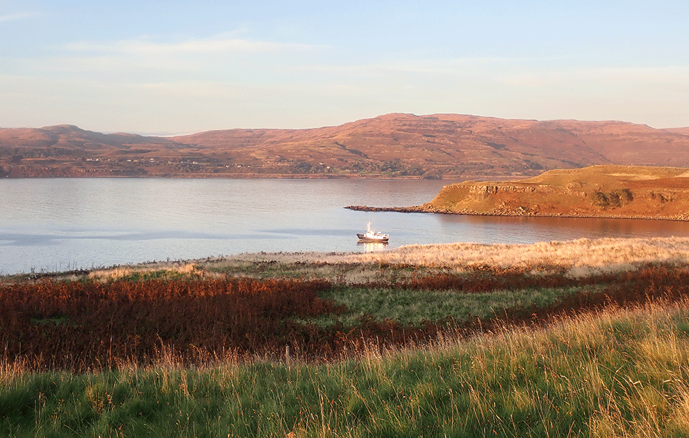
Once back aboard Hjalmar Bjorge we decided to head over to Rum for the night, and under brilliant sunshine we motored around the north side of Rum to find an anchorage in Loch Scresort. At the head of the loch we could see the red sandstone Kinloch Castle, built by the Bulloughs in 1902.

The ferry Loch Nevis arriving at Rum
Kinloch Castle
We went ashore on Rum the next morning. At the pier there was an info-board listing castle tours. I wanted the guests to see inside the castle, and even though it was a Sunday, there was a tour listed for 9:30. And so we all headed over to the castle. 9:30 came, and went, as did 10:00. We asked the few folks we could find about the tour, but no one knew anything. (We got the definite feeling they just didn't care.) I wandered over to the shop/pub to find it open, but vacant, its outdoor tables littered with empty beer and wine bottles. It looked like we'd missed quite a party. 

Kinloch Castle
We missed the party
I won't dwell (much longer) on the complete disregard whoever runs Rum has for visitors. But if you are not going to offer tours, why in the world do you put up signs saying you do. And I know for a fact that our experience that day was not just a one time mixup - it happens all the time. If you ever go to Rum, don't plan on seeing the castle, get as far away from it as you can and spend your time in the hills.

The sun was shining bright as we left Rum and made the journey over to Eigg. Rounding the north end we motored down its east coast below the high cliffs of Striudh. It was at Striudh that Hugh Miller met a lass "who was more than merely good looking" (see book 1, chapter 26).

Striudh - Eigg cliffs
We were soon ashore on Eigg, where we arranged for a taxi to take us the five miles across the island to the Singing Sands. It was the only taxi on the Small Isles, an old London cab, that had somehow made its way to Eigg via Dundee.

Eigg taxi
We had a bumpy, but fun, ride up Eigg's M-1 to road's end at Howlin, where a short walk took us to Camus Sgiotaig, the Squeaking Bay (usually known as the Singing Sands).

To the Singing Sands
The Singing Sands - the mountains of Mordor in the distance
East of the Singing Sands, and just under the high cliffs of Cleadale, we could see the house at Howlin. It's said the JR Tolkien stayed here, and that the view he had of Rum from the house was the inspiration for the Mountains of Mordor.

Howlin House (at left)
Could this be Mordor?
After an hour or so making the sands sing and wading in the sea we headed back to the road-end to find our chauffeur patiently waiting to take us to Glamisdale. (Listen to the April 19, 2013 post for a recording of the singing sands.)

Our taxi awaits
Back in Glamisdale we still had an hour, and so Nigel and I set out to see Massacre Cave. There was a sign in the shop that said due to a rock-fall you could not get into the cave, but we decided to take a look for ourselves. It is an easy half-mile walk to the cave, and when we reached it there was no sign of a rockfall, and with flashlights in hand we crawled in. In the late 1500s several hundred people perished here - see chapter 24 of book 2 for the story.

Nigel at Massacre Cave
In the cave
Thirsty, and ready for a beer, Nigel and I returned to Glamisdale only to find that the pub had just closed. The rest of our group had been more fortunate, making their way to the pub in time to get a drink. And so we spent a leisurely (and beer-less) half hour sitting in the sun until it was time to depart. Our next destination, and the last island of the trip, would be nearby Muck.

Glamisdale Harbour - Eigg
We dropped anchor at Muck around 7pm. And after another excellent dinner prepared by Lynda we settled down for the night. The next day dawned without a cloud in the sky, and we went ashore for a few hours. As we stepped ashore we set a record for a Hjalmar Bjorge cruise, as we'd visited all four of the Small Isles. I led the guests across the island to beautiful Gallanach Bay, and then several of us continued on to the MacEwen graves on Aird nan Uan, the headland of the lambs, on the far west tip of the island. (The MacEwens own Muck.)

Gallanach - Mordor in the distance
MacEwen Graves
Then in the mood for a climb, Nigel and I decided to make our way up Beinn Airein, at 450 feet, the highpoint of Muck. At the base of the hill, just before we started to climb, we came across an amazing stone cottage. Its turf roof was intact and the house still appeared to be used. It is a listed building that was restored in the 1960s (you can read more about it on this CANMORE page).

Someone's home sweet home
Nigel atop Beinn Airein
Looking to Eigg from the top of Muck
Unlike our experience on Eigg the day before, when we returned to the harbour the tearoom/pub was open, and so we were able to quench our thirst before returning to the boat.

Muck Tea Room/Pub/Shop
While talking to the folks who run the tearoom I was sad to learn that Amy had passed away. Amy was a little dog that had followed me all around the island on my two previous visits (see the October 13, 2013 post for more on Amy). But I was happy to learn that Amy's daughter, Mattie, still greeted visitors, as I found out when I stepped out of the tearoom.

Mattie of Muck
Amy of Muck - RIP
We said goodbye to our last island and set a course east to the Sound of Mull, where we motored into Lochaline harbour for a short visit ashore. Lochaline is where many of the St Kildans were sent, some to do forestry work, when they left their far off (and treeless) island in 1930. Most of the guests went for a long walk up the lochside road. But I decided to get a beer at the Lochaline Hotel, and then take a look at the houses where the Kildans had lived.

Lochaline Marina
Lochaline Houses - near where the Kildans lived
We spent the last night of the cruise at anchor in nearby Ardtornish Bay. The house at the head of the bay is the sometimes residence of Adam Nicolson, the author of the best book about the Shiants (Sea Room).

Ardtornish House
In the morning we had a short sail to Oban where we had a gigantic breakfast that would keep everyone going for a day or two and, in short order, everyone went their own way. It had been an interesting trip, one that visited quite a few islands not normally seen on these cruises. I would like to thank Nigel and Clare, Janet and John, Joey, Patricia, Francis, and Elaine for being such good company. I hope you all had a good time. And many thanks to Mark, Anna, and Lynda, for making my first trip as a guide go smoothly. We will be doing another trip next year, from May 20th to 29th. Check the Northern Lights website (and this blog) in the next few weeks for details.

Hjalmar Bjorge at Oban