Saturday, July 27, 2013

A Tale of Two Boots - Rhenigidale 4

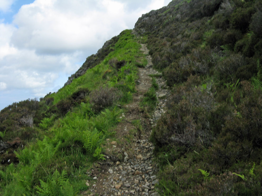
The next day I drove the road to Rhenigidale and parked at the trail-head west of the village. The path contoured down around a headland to give me this great view of the beach at Trollamarig and above it the switchbacks I'd descended (and ascended) the day before.

The trail then passed down and through the abandoned village of Gearraidh Lotaigear where a shop once offered provisions to those passing through to Rhenigidale.


It was a much shorter hike than the day before. I soon found myself once again at Trollamarig Beach; the sky a bit grayer than the day before.


I enjoyed a beer on the beach to celebrate having 'closed' the loop from the previous day's effort, and then started back up the path to return to Rhenigidale.


As I hiked back to the car the gray sky darkened further, the wind picked up, and a light drizzle started. Reaching the car I opened the rear door on the passenger side and sat down to change out of my hiking boots. I had just put my street shoes on when a blast of wind slammed the open car door on my legs. So I got up and walked around to the driver's side to finish changing out of my sweaty hiking shirt. I was so tired and hungry that once I had a fresh shirt on I drove off. 

A day later I was on the mainland, 150 miles from Rhenigidale. I wanted to go for a hike up Beinn Dubh, which rises high above the village of Luss on the western shore of Loch Lomond. My boots were nowhere to be found. It was then I realized I'd driven off and left them at the roadside above Rhenigidale.

So here I am today, bootless in Seattle. But good things happen to those who blog. My July 8 post on Ardveg was of interest to someone who lives in Rhenigidale. So thinking the odds were against it, I asked if any boots had turned up. A couple of days later the answer came back. Yes. And so on my visit to Harris and Lewis next week I will be going to Rhenigidale to fetch those wayward boots. I hope they were rescued before any sheep had a chance to gnaw on them.

Friday, July 26, 2013

A Tale of Two Boots - Rhenigidale 3

Although there is a 'shore' path to Molinginish marked on the OS map, it is not much of a path. It started out easy enough, a rough track branching off to the SE.


But it soon turned into more of a game-track that cut through deep heather. A short way into it I had to slowly cross a steep stream that was in spate due to the recent rains. After that, about halfway to Molinginish, I came to a nearly vertical stream, a mini waterfall that had to be crossed. There was no safe way across, especially for someone hiking on their own. In a very disappointed mood I decided to turn around.

After bashing back through the heather to the Rhenigidale path I knew for sure I did not have the energy to carry on to Rhenigidale and then return to Urgha. So I started back up the switchbacks to retrace my walk in.


On the descent to the car I noticed this memorial stone I'd missed on the way up. It is to Duncan Macinnes who died here in 1908, and to his grandson (with the same name) who died near here in 1982.


Next time we'll drive to Rhenigidale to walk the eastern half of the path. And in the process I'll loose my boots.

Thursday, July 25, 2013

A Tale of Two Boots - Rhenigidale 2

From the Molinginish stone I continued to an amazing section of switchbacks that steeply dropped 1000 feet to the sea.

Highpoint - Shiants in the distance
The steep descent starts
Switchbacks down to Trollomarig
Bridge at Trollamarig Beach
Trollamarig Beach
From here more climbing awaits to get to Rhenigidale. Before the road reached Renigidale in the 80s, this path was the main way for hikers to get to the Gatliffe Trust Hostel. It would be a good days work to get to the hostel on this path carrying a full pack, and it was at this point that I realized I had been too ambitious. There was no way I could carry on to Rhenigidale and then see Molinginish. So I decided to turn right, take the 'shore' path to Molininish and climb back up the pass to return to the car. Then, on the following day, I would drive to Rhenigidale and hike the path from there to this turnaround point at Trolomarig, so I'd have walked the entire path over a two day period.

The 'shore' path to Molinginish was barely visible, cutting through the deep heather as it headed SE above the coast. I was looking forward to seeing Molinginish, but as you'll learn next time, a quarter mile down the track I'd discover that Molinginish would be unreachable.

Tuesday, July 23, 2013

A Tale of Two Boots - Rhenigidale 1

The trek to Rhenigidale, along the path from Urgha on Harris, is an iconic Hebridean hike. Before a road was built in 1987, the only way to reach Rhenigidale was by sea, or by this exhilarating path that starts on the road two miles east of Tarbert. I had started to follow the path once many years ago, but a thick fog made visibility near zero, so I turned back. But a few weeks ago, while saying on nearby Scalpay, a clear day tempted me to try the walk again.

As I looked at the map, an intriguing loop hike presented itself. The OS map shows a 'shore' path that links Rhenigidale to Molinginish, another old settlement on Loch Trollamarig. So I decided to make a long loop hike. Starting from Urgha I would go to Rhenigidale, then backtrack to the head of Loch Trollamarig to follow the shore path to Molinginish. I would then return to the car by climbing the Molinginish path back to Urgha. A bit ambitious, but it would make for a great day of walking.

Two minutes into the walk - looking back to the parking area at Urgha

The walk starts with an easy climb east to the pass

And soon the summit cairn is reached

Summit Cairn - Shiants can be seen in the distance
After descending a ways I reached this marker stone where the path to Molinginish branches off
At this point I was still planning to carry on to Rhenigidale, swing through Molinginish, head back up the hill to this marker stone, and then return to the car. As you'll find out next time, it was not to be.

Monday, July 22, 2013

A Tale of Two Boots

Good hiking boots are the most important piece of equipment when exploring the islands. About five years ago I bought a pair of Asolo TPS 520s. After walking in them for 50 miles they broke in and fit me like a glove. Since then they've carried me successfully across the rough terrain of some 25 islands. So it was a sad day when I lost them after a hike on Harris last month. So how does one lose their boots? Over the next few posts I'll tell you as we make the famous hike to Rhenigidale. 

Warming up on Jura

Sunday, July 21, 2013

Eilean Bhan - 3

My guide, Mike, unlocked the outer door and allowed me to walk around the balcony of the lighthouse. Unfortunately the looming Skye Bridge hogged the view.

View from the balcony

Looking towards the old Keeper's House from the balcony of the light
After climbing back down the tower Mike led me over to the hide, well stocked with binos and birding books. It would be a wonderful place to spend a few hours with its view over the north of the island looking towards Raasay.

Inside the hide
Before leaving the island I had to sit on the trig pillar that marks its highest point. I'd seen the pillar on every crossing of the bridge over the past 18 years, so it was great fun to finally sit on it.

Atop Eilean Bhan

View from the Trig Pillar

Friday, July 19, 2013

Eilean Bhan - 2

The 70-foot tall Eilean Bhan lighthouse was built in 1857, automated in 1960, and made redundant when the Skye Bridge opened in 1995. What with all the Health & Safety regulations these days it was a surprise to me that I would be allowed to climb to the top.


After walking across the recently painted five-span plate-iron footbridge to reach the tower my guide, Mike, unlocked the door. We then climbed a narrow circular staircase followed by a series of steep ladders to reach the lantern room.


After reaching the lantern room Mike surprised me by unlocking the door to the balcony. Next time we'll step through that door and take a look around.

Thursday, July 18, 2013

Eilean Bhan - 1

The island is Eilean Bhan - The White Island - which now serves as a footing for the Skye Bridge. When the bridge first opened a security camera was placed to monitor the access point to the island. This pesky camera discouraged me for several years from jumping the wall and exploring the island.

Eilean Bhan became famous as the residence of Gavin Maxwell after his home at Sandaig burned down. I was made aware of the history of this little island by reading John Lister-Kaye's book The White Island. And the photo in the last post was of the memorial to Teko made by John Lister-Kaye. Teko, the last of the Ring of Bright Otters, died in 1969.

These days the camera is gone, and the island is easily accessible via guided tours offered by the Bright Water Centre in Kyleakin. Last month I phoned them up and signed on to one of their tours. Driving onto the Skye Bridge I parked in a small parking area recently made by the gate that gives access to the island. There I was met by Mike, who told me I was the only one who'd wanted a tour that day. Our first stop was the memorial to Teko, and then Mike showed me around the old Keeper's house that Maxwell had renovated.


Our next stop was the Lighthouse. I have been to many a Scottish light, but this was the first one that I have ever been allowed to climb. Next time we'll ascend a steep sets of stairs and ladders to reach the top of the light.

Tuesday, July 16, 2013

Mystery Island

Here's an island trivia question: What island is visited by hundreds of people every day, but very few of them know they are on it?

Over the years I've been on this island about 30 times, and each time I dearly wanted to see more of it. But a wall with a locked gate, and a security camera, discouraged me from trying. The photo below is a hint to what island I am talking about. Over the next week we'll get through that locked gate to wander around this little island.


Monday, July 8, 2013

Journey to Ardveg

It was only nine days ago I was in the Ardveg. Now I'm home, 4279 miles away (or so my GPS tells me), and have finally readjusted to Pacific Time, eight hours behind AST (Ardveg Standard Time). On Saturday, June 29, I attended the book launch of An Trusadh - Memories of Crofting in Ardveg, by John MacDonald. I've read the book over the past few days and it is wonderful.  

After the launch, which was held in the Uig Community Centre, the plan was to visit the Ardveg by sea. But the boatman decided the sea was a bit rough and the boats were cancelled. So it was time for Plan B. A fleet of 4x4 vehicles was assembled and we set off along the Burma Road to Hamanavay. I have walked this hellish road three times now, so it was nice to be driven its nine miles of agonizing curves, bumps, and ups and downs. 

But more work still lay ahead of us, for Ardveg lies a trackless hard mile from Hamanavay. So a parade of some 40 souls set out to cross the wet, grassy hillside to Ardveg. It took a strenuous half hour hike to get there, but it was well worth the effort to reach this place; to see it knowing that its story was now captured for posterity in John's book. Another special part of the visit occured after we'd been there an hour. For it was then that John Macdonald's sister Ina showed up, having managed to make the walk to see the house where she was born. 

We had a marvelous time, and the place looked just as it had when I camped there in 2001 (see May 23rd post for some photos from that trip). After spending two hours exploring we hiked back to the cars. Just as we reached them the heavens opened up. But the rain did not dampen our spirits, for it had been a special day for all. What follows are a few photos of our day in Ardveg. If you want to see what Ardveg looks like from space you can find it on GoogleEarth at the following coordinates: 58.06487, -7.03338.

Main Fireplace in the original Black House
Roadway built by John's father that leads down to the jetty
Jetty - the whale rib-bones once used to roll the boats up are long gone

Beautiful stone Boathouse (left) built by Andrew Miller-Mundy, a resident of the new house long after the Macdonalds left
This ugly scar on the hillside is the Burma Road to Hamanavay (but we would not have been able to get to Ardveg that day without it)
Rowan tree and the walled garden - John writes of having a swing in the tree
The house built by John's father to replace their blackhouse (which can be seen in the centre distance)
John's sister Ina (in black coat) at the house she was born in
Original blackhouses. John's family lived in #1 (to the right)
Close up of the original #1 Ardveg
The nearby mill on Abhainn Grunavat
On the way back as a misty rain moves in - the foot bridge over the Hamanavay River - Hamanavay Lodge in the distance