Showing posts with label Great Bernera. Show all posts

Monday, September 5, 2022

Bernera Bridge - Old and New

Last month I had an extraordinary opportunity to spend a day on Loch Rog to set foot on four of its now uninhabited isles. The boatman picked me up at Bosta beach, at the north tip of Great Bernera—the 'Best Beach' as it's called by the locals. To get to Bosta I had to cross the Bernera Bridge, which I'd last traversed in 2019. As I approached the bridge things looked quite different. The road suddenly curved right and, instead of leading to the 100-foot-long pre-stressed concrete bridge of 1953, took me across a brand new, steel-girder bridge, which was opened in December of 2021.

Once over the bridge, I climbed to the standing stones of Callanaish VI to take a photo of the old and new bridges. Standing side by side above the swift-flowing waters of Struth Earshader, the bridges are the reason Great Bernera is still a vibrant, living island.


Friday, October 27, 2017

Calanais VIII

Usually, when I tell someone I've spent time on Lewis, they'll ask if I've seen the Calanais Stones. When that happens I'm always tempted to ask, Which Calanias stones?  There are about twenty sites: Calanais I, II, III, IV, V, and on up to XIX (see this map). There are even more sub-categories; for example there is a Calanais VIIIa.  For all I know there may even be a Calanais XIXf. All these site have more descriptive Gaelic names, which you can find here.

When I visited the unusual stone setting above the Great Bernera Bridge last July, I did not know at the time that it, too, had a designation: Calainis VIII. (It also has two Gaelic names: 'Tursachan' and 'Cleitir'). This site is unique in being an arc of standing stones; stones that stand like a megalithic shield facing the mainland across the narrow gap between Lewis and Great Bernera.


There is some thought that one of the purposes of this site was as a Beltane sunrise marker, halfway between the spring equinox and summer solstice. See this CANMORE page for a description of how this worked in conjunction with stones a mile to the northeast.  It is a complicated site, one that also includes outlying stones that mark extreme moon rise locations.


I learned something astounding while reading about Calanais VIII. About three miles due south, on the side of Beinn Fuathabhal, is a rarely visited stone circle; rarely visited because it's two miles from the nearest road. From inside this circle, which is at an elevation of 500 feet, all of the Calanais sites are visible (see this page). It sounds like a hike worth making, and one I plan to do next summer. 

Monday, October 16, 2017

The Great Bernera Loop

Next time you are on Lewis, a great day-out is to pay a visit to Great Bernera. And while there, be sure you walk the magnificent Bernera Loop, a six-mile trek that usually starts at the museum in Breacleit. But I had the luxury of starting from home; Atlantic View Cottage, where my wife and I stayed for a week this summer. Better accommodation on Great Bernera would be hard to find.

Atlantic View Cottage
The route passes right by the cottage, and so on a fine July day I set out to make the walk. It starts by going up the west side of the island to Tobson, and then on up to the north end at the Bosta roundhouse.


The adventure really began when, after just five minutes of walking, I reached the end of the tarmac road and a footbridge over the Atlantic (a little bit of it, anyway). An old map from the 1800s shows stepping stones here - the bridge is a big improvement.


From the bridge the route leads out to open countryside, with amazing views over West Loch Rog.


After a mile of truly exhilarating walking the trail drops down to the road at Tobson near Thule House. Thule was one of the first 'white' houses built on the island (see this link). The author William Black, who wrote The Princess of Thule, stayed here often (see chapter 27 of book 2).

Tobson and Thule House
Once you cross the road a signpost points the way up and over a ridge to the north.


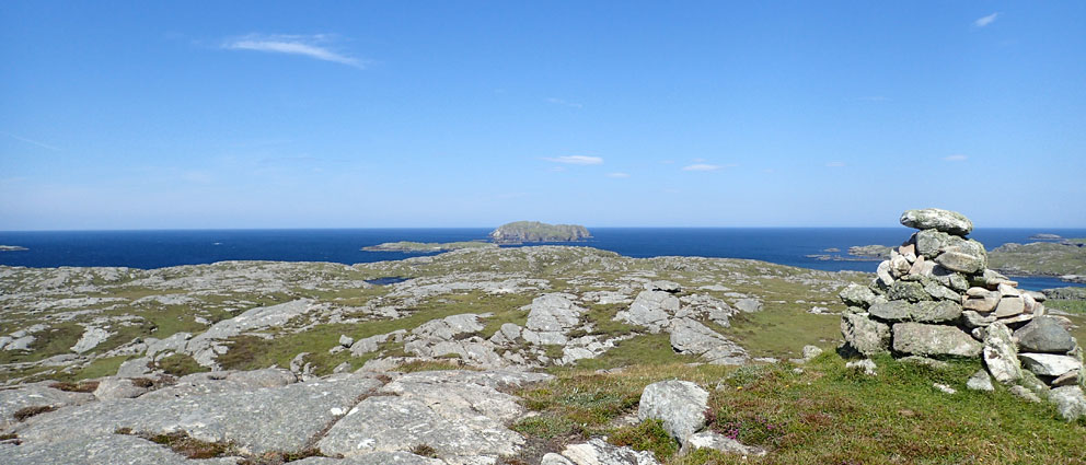
After a bit of huffing and puffing you reach a remarkable viewpoint atop the highest ground on the northwest corner of the island where all the isles of Loch Rog come into view.


Looking north - Little Bernera in the middle distance
I took a break here to savour the view (and a beer) before heading down to Bosta Beach and the Iron Age roundhouse. If you ever pass this way be sure to pay a visit to the roundhouse. The local guides give an excellent talk. I had been here two months previously (see the July 26, 2017 post), and so I walked by it to make my way to the road.


From here on the walk is on tarmac. As I followed the road over the high ground to the east there were some amazing views of Little Bernera.


The landing on Little Bernera
The road then turned south to cross a mile of open countryside, passing a couple lochs along the way. This is the least interesting bit of the walk, and the road can be busy with traffic going back and forth to the beach. I tried to hitch a ride here, but no one stopped for me.


When you reach the turnoff to Tobson there is a large memorial cairn to the 1874 Bernera Riot. See this Virtual Hebrides webpage for the story of the riot.


A mile past the cairn you reach Breacleit, the main settlement on the island. Here you'll find an excellent museum and cafe. Many who visit Great Bernera for the day park their cars here to make the walk. 


Near the centre you will find this hilarious set of pants-planters.


From the Community Centre I turned onto the Bhalasaigh road to make the half-mile hike back to our cottage. It had been an amazing hike, and the next time I'm on Bernera I hope to make the walk in the opposite direction.

If you are ever on Lewis, and looking for something to do, I can't think of a better day out than walking the Bernera Loop, and then having a meal in the cafe.

Tuesday, August 22, 2017

The Great Bernera Mill

For me, seeing the restored Great Bernera Norse Mill was a two-year challenge. I first saw it from the sea in 2015 (see the June 30, 2015 post). It looked so intriguing I promised myself that someday I'd take the time to walk to it.


And so, a year later, with Explorer Map 458 in hand, I walked to the end of the road east of the Bernera Museum. The map showed a dotted line path that went directly to the mill, a quarter-mile farther east. All I saw at the road's end was a gate leading into a marshy field. There was nary a trace of a path of any kind, and it looked so swampy I knew I'd sink to my knees if I tried to cross it. You can see the gate to nowhere at the left in the following photo.


I scratched my head, looked at the map again, and gave up. It was late in the day, and the museum was closed. With no one around to ask directions I drove to the Bernera Mini-Mart. I showed the man on duty the map. He had no idea where the path was.

I then drove the east Bernera circuit road looking for a way to the shore. I saw nothing that looked doable, and gave up. My wife and I were returning to the mainland the next day, so I had to put seeing the mill on the list for next time.

So, fast forward to last month. My wife and I were staying on Great Bernera for a week. On a clear, sunny day I set out to visit the mill. I asked for directions at the museum, telling them about my previous failed attempt. They told me to simply follow the red marker posts, and so I returned to that same road's end I'd visited the year before. There were no red posts anywhere, just that same swampy field beyond a gate; a gate that looked like it had not been opened in years.

I returned to the museum and told them so. The woman on duty said there'd been some 'vandalism'. What! Vandals attacking marker posts on Great Bernera?  This was certainly odd. Then she gave me the key to the mill; not a real key, just a suggestion. I needed to walk right up to the house at the end of the road, which you can see to the upper right in the previous photo.

And so I walked up to the house. And there it was. Just to the left of the driveway stood another gate not visible from the road below. This must be the place. But there was no red marker post, or a sign of any kind. Very odd.


I could be wrong, but I surmised the 'vandalism' was that the marker post had been removed to discourage walkers from passing so close to the houses. After following the path past the house I finally came across a red post, one not visible from the road.


From there a series of posts led east over a hill. From there ten minutes of walking brought me to the mill on the shore of Loch Riosaigh.


It was fantastic, like stepping back in time. The mill was used until the 1920s, and had been rebuilt in 1995. Its restored thatch roof was mostly intact, and along the side of the building the mill race flowed to the sea. 


Water in the mill race could be redirected to flow through the lower level of the mill to turn the paddle-wheel. But the water was not going that way so, torch in hand, I entered the dark opening to see the wheel.


On the upper level of the mill were the two millstones, and a wood funnel used to pour grain into the stones.


I then thought about visiting the giant lobster pond and dam on the far side Loch Riosaigh. I'd seen it from the sea back in 2015, and it looked like quite an impressive structure. It is one of the largest lobster ponds in the isles, and was in use until the 1960s. (You can read more here.) 


The pond was only 500 meters away. But getting there involves following the rough coastline around the head of the loch, a distance of 1000 meters. It was getting late, and so I decided to save it for next time. Before heading back I walked out to the tip of a small headland east of the mill, as I'd seen some sort of structure there. On reaching it I discovered it was just a large cairn, probably built by hikers taking a break in this beautiful spot. I left my own mark by building a portal dolmen from three large stones.


Looking at my handiwork I started chucking to myself. I'd suddenly recalled a hilarious event that happened many years ago in the west of Ireland. I was at the Polnabrone Portal Dolmen, one of the most impressive dolmens in the world. I was with Gloria and Regina, two of my nieces. After seeing the dolmen we walked out onto the rocky terrain of the Burren, where we sat down and set about building our own mini-dolmens from the many flat stones that covered the area; none of them more than six inches high. No sooner had we finished when we heard stomping behind us. Up walked the site warden, who proceeded to knock down our creations. He seemed to think future researchers would confuse our little dolmens with the real thing.  

There was no warden at the mill to knock down my creation, only the coming winter storms. I left the headland and made the short walk back to the road. At the hidden gate I was tempted to transplant one of the red posts to it, so it would be visible from the road. But it would probably disappear, too.

Now that you know the way, if you are ever on Great Bernera be sure to visit the mill. It is well worth the short walk. You can read more about the mill here.