Sunday, March 29, 2015

On Roads to the Isles - 6

No thread on Roads to the Isles would be complete without a mention of the Reverend Kenneth MacLeod (1871-1955), best known as the author of the well known 'Road to the Isles',

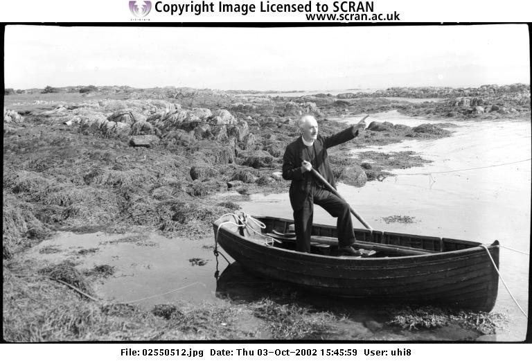
I first learned about Kenneth MacLeod in Alasdair Alpin Macgregor's Skye and the Inner Hebrides. Chapter 17 of the book is about Cara, and in it Alasdair visits the island in the company of Kenneth, and together they explore the ruin of Cara House and sit on the Brownie's Stone. This wonderful tale inspired me to get to Cara back in the 90s to do the same.

Macleod was born on Eigg in 1871. After being ordained in 1917, he was the Church of Scotland parish minister of Colonsay and Oronsay until 1923, and then moved on to Gigha, where he was minister until 1947. Macleod passed away in 1955. He was buried in Taynuilt, and on a weekday about 10 years ago, I wandered around the Taynuilt cemetery in an unsuccessful search for his grave. A few years later I returned on a Sunday and asked to look at the burial records. Surprisingly, they had no idea who Kenneth MacLeod was, but they were able to find his grave for me. It is easily located by standing under the Sheela-na-gig on the south wall of the church, and then walking across the cemetery towards the highway. Just where the ground starts to slope downwards you will find the grave (see photos below). You can read his obituary here, and be sure to see this link for a photo of him on Gigha in the 1940s.

I'd like to end this series of 'On Roads to the Isles' posts with this dedication to Kenneth Macleod from T. Ratcliffe Barnett's The Road to Rannoch and the Summer Isles (1924):

TO KENNETH MACLEOD
Bard of the isles: Gleaner of Gaelic Legendry: and high priest of the great mysteries - in memory of a day in Mull when he made us see, with Columba's eyes, the vision at the white table - these papers are dedicated by a wayfaring man who has seen something of God's beauty in the bens, the glens, and the islands, and has found many a fortune in the heart of his fellow-travellers.

Muckairn Church - Taynauilt
 Muckairn Church with the ruin of the older church in the foreground
Carved stone from the original church (possibly a Sheela-na-gig)
Grave of Kenneth Macleod
Macleod tombstone - Kenneth's memorial is at the bottom

Thursday, March 26, 2015

On Roads to the Isles - 5

The most frequent road to the isles I've taken is the 90 mile drive from Glasgow to Oban. There are many wonderful places to visit along the way, and the first I'd like to describe is Baile Mhoadain. It is a bit off the road, for when you reach the Connel Bridge, five miles before Oban, you have to take the highway north over the bridge, and immediately turn right at the road to Ardchattan.

Follow this road for five miles and park in the small parking area for Archattan Priory. The Priory itself is worth a visit, but my favourite spot lies hidden on the hillside above the Priory. On the west side of the car park you will see a gate, and a sign that says 'Walk to Ancient Church and Graveyard - 1800 mtrs'. Pass through the gate and head north across the field.

Gateway to Baile Mhoadain
The distance mentioned on the sign is exaggerated - perhaps to discourage visitors - as the site lies only 400 meters to the north. A 15 minute hike up the hill, across a field usually occupied by sheep, brings you to to Baile Mhoadain: the settlement, burial ground, and holy well of St Modan.

Baile Mhoadain
St Modan is thought to have worked in the 8th century. He died in Rosneath, but his first settlement n Scotland may have been at Ardchattan. Here is a description of the site from R. H. Story's St Modan of Rosneath (1878):

A short distance from the site of the old Priory of Ardchattan, near Loch Etive, may still be seen the remains of his first oratory. It bears the name of Balmodhan (St. Modan's Town); a few paces from its ruins is a clear spring called St. Modan's Well, and hither within the memory of persons still living came many a pilgrimage in honour of the saint. A flat stone near was known as St. Modan's Seat. It was broken up for building materials by Presbyterians not many years ago.

The ruins are situated amid scenery of impressive beauty, and command a view of land and water as far as the island of Mull. The masonry is strong and rough, but little more than the gables and the outline of two broken walls remain, overshadowed by the ash trees that have planted themselves among the stones, the existing trees growing out of the remains of roots, all gnarled and weather-worn, of immensely greater age. In every crevice thorn, rowan, ivy, and fern have fastened themselves, softening and concealing the sanctuary's decay.

The tumbled ruin of St Modan's Church
Inside St Modan's
Hidden in the vegetation east of the church, just above the west bank of a small stream, you will find St Modan's Well. Tucked up inside the well is a cup and, below it, a scattering of coins left as offerings. 

Water flows from the well of St Modan
Cup in the well
When I first visited the well its water fell from a spout into a dark pool filled with sheep droppings. It was a sad sight, and so I spent the better part of an hour scooping out the mess. In the process I discovered a large flat stone lying in the pool below the spout. With the pool cleaned the water splashed down onto the stone before draining to the stream. But when I visited again a few years later the stone had sunk out of sight into the mud.

See this RCAHMS page for more on St Modan's Church, and this page for more on the well.

Sunday, March 22, 2015

On Roads to the Isles - 4

Another road to the isles is the long drive to Tayvallich, where you can catch the passenger ferry to Jura. But before going to Jura you should drive another five miles beyond Tayvallich to the end of the B8095, where you'll find Cill mo-Charmaig, better known as Keills Chapel.

The chapel has been re-roofed, and inside you will find an assortment of West Highland tombstones and crosses, including the beautiful Cross of Keills. When the cross was moved inside the chapel a replica was mounted outside the chapel on the original site of the cross. 

Keills Chapel and replica cross
Tombstones inside the chapel
The jewel of the collection of stones is the 7th (or 8th) century Cross of Keills, which was moved into the chapel about 35 years ago.

The Cross of Keills
The chapel is dedicated to St Charmaig, who is though to have worked in the area in the early 7th century. He had a hermitage on Eilean Mor Mhic O'Charmaig, one of the MacCormaig Isles, three miles south of the chapel. See the January 29, 2014 post for a description of a visit to Eilean Mor.

Replica cross - MacCormaig isles in the distance
See this RCAHMS page for more on the chapel of Cill mo-Charmaig, and this RCAHMS page for photos of the cross before it was moved inside.

Wednesday, March 18, 2015

On Roads to the Isles - 3

A visit to the 12th century Kilmory Knap Chapel is a long detour off the road to Crinan and the isles, but it's worth it. To get to it from Daltote (see March 15th post), continue south on the single track for another seven miles. 

Kilmory Knap Chapel
Like many of the 'mory' place-name dedications, Kilmory Chapel is dedicated to St Mealrubha. St Mealrubha founded a monastery at Applecross around the year 673, which is where he died at the age of 80 in the year 722. During those years his work took him all along the west coast of Scotland and the isles as far north as Lewis, and so the church he established at Kilmory Knap predates the chapel ruin you see today by nearly 500 years. Places dedicated to Mealrubha abound and, to me, the most interesting is little Isle Maree in Loch Maree. (See the June 24, 2014 post for a visit to Isle Maree.) 

Inside Kilmory Chapel you will find an amazing assortment of carved West Highland tombstones and crosses. 


The most impressive stone is the 15th century MacMillan Cross, dedicated to Alexander MacMillan, the keeper of nearby Castle Sween. One side of the cross depicts the crucification, the other a deer hunting scene with dogs (the huntsman on the cross may be Alexander MacMillan). The cross stood outside the chapel on a pedestal for 500 years or so, until being moved inside in 1981.

The MacMillian Cross
From Kilmory there is an amazing view west to Jura and the MacCormaig isles. On the largest of the Macormaig's is the chapel and cave of St Charmaig (see book 2, chapter 4). It was the road to those isles that first took me to Kilmory.

Jura and the MacCormaig Isles
The MacCormaig Isles
A mile beyond Kilmory you will reach the end of the public road, and the start of the private track to Ellary. Although the road is private, you can still walk it. A treasure lies down this road, for hidden in the forest is the ancient burial ground of Cladh a' Bhile, where you'll find an incredible assortment of carved cross-stones and some more recent graves. When I visited the burial ground it did not even occur to me that I'd need to ask permission. I just went there (it was hard to find, as it's in heavy woodland about 300 meters off the track). Since then I've learned that all who do ask permission to see this historic site are turned away, including someone who just wanted to take a photo of a tombstone in the burial ground as part of the War Graves photographic project. Although they eventually managed to get one (see this War Graves page).

See this Historic Scotland page for more information on Kilmory.

Sunday, March 15, 2015

On Roads to the Isles - 2

Another road to the isles is the route to Crinan. From Inverary you follow the A83 south to Lochgilphead, and then head west on the B841 towards Crinan. Whenever I pass this way I try to take the time to make a diversion south from Bellanoch to see the 6th century Daltote Cross and Kilmory Chapel.

Many people visit Kilmory, but few take the time to see the Daltote Cross. I first learned about it in chapter 3 of T. Ratcliffe Barnett's The Land of Lorne (1933); in which he relates a visit to the cross in the company of one of the sisters that lived in Daltote cottage, which lies on the road 300 feet east of the cross.

To get to the cross you drive south for a mile on the Tayvallich road from Bellanoch (which is next to the Crinan Canal). Here you will reach a left hand turnoff to the minor road to Kilmory Knap. That's the way you want to go, but before heading down this road stop and pay your respects to the beautiful war memorial: a replica of the Kildalton Cross on Islay.

The War memorial
From the memorial follow the road to Kilmory for seven miles until you reach a slight bend in the road (where a private, gated track, heads off to the right). You can leave your car here, as there is just space enough space to park on the west side of the public road. The cross lies a quarter mile down the gated track.

The track beyond the gate leads to the cross
When I first visited the cross there was a sign on the gate that showed a woodland walk down the path. The last time I was there the sign had disappeared - but there is still a sturdy stile that allows you to get past the gate. Once afoot, cross the stile and head south for a quarter mile. At a spot where the track drops and turns hard to the right, keep walking straight for a hundred feet or so into the moss, grass, and bog, and you will see the marker sign for the cross.

Footpath route to the cross
The cross, incised on a large upright slab, is beautiful, but a bit sad; as it's flaking away with the elements. It is carved inside what looks like the mirror symbol you find on some Pictish Symbol Stones, and I wonder if this might be a Christianized symbol stone like the one on Pabbay.

Below the cross is a Holy Well, and here and there you'll find old stones that may mark ancient graves. It is a peaceful spot, and in the three times I've visited over the years I've never run into anyone else. Chances are, though, that you won't be entirely alone, as it can be very midgy. So come prepared for the bugs. See this RCAHMS page for a photo of the cross in better days.  Next time we'll continue on down the road to Kilmory Knap Chapel.


The Daltote Cross

Thursday, March 12, 2015

On Roads to the Isles - 1

Over the years I've followed several roads to the isles. For me, they all start start at Glasgow Airport, and end at Kennacraig, Oban, Crinan, Mallaig, or Uig (Skye). There are many sights to see along these roads to the isles, and I make it a point to spend a few days traveling them before setting off for the islands. (Another reason I do this is that it allows my baggage to catch up to me if the airline manages to lose it.) Over the next few posts I will describe some of the sights I've seen on these roads to the isles.

The first such sight I'd like to describe is one of the best groupings of ancient rock-art in the UK. I visited it on the way from Glasgow to Oban by making a detour through Kilmartin Glen. From Kilmartin Village I drove a mile and a half north to Carnasserie Castle. 

Carnasserie Castle
I left the car there and followed a path to the west of the castle into a forestry plantation. It was a six-mile round trip walk from the car park, and I've highlighted the route I took to Ormaig in this GoogleEarth image.

Walking route to the Ormaig Stones 
As it turned out, I was fortunate I arrived there on a weekend, as I had to walk though several stretches of forest that were being logged. If I'd tried to pass through on a weekday I'd of been turned away. Half the walk was along wooded trails, the other half on dusty forestry roads marked with keep-out signs warning of heavy logging traffic. But as it was a Sunday, and the forest was quiet, I carried on past the signs. If not for my old Pathfinder Map of the area (Pathfinder, 365 Scarba), I would not have been able to find the stones, as a number of forest tracks made navigation a challenge. But that excellent map, along with my GPS, led me west to Loch Craignish, and on a recently logged hillside I found the Ormaig Stones (NM 822027).

The site consists of a couple hundred carvings spread out over several slabs. The most interesting are rosette carvings often referred to as 'telephone dials', as they resemble the dials of old rotary phones. Below are a few photos of the Ormaig stones I took in 2011. See this Megalithic Portal page, and this RCAHMS page for more photos of these amazing works of art.

After that exhilarating hike I drove up to Oban and checked into the Kimberley Hotel (which is now called Greystones). I'd been awake for 25 hours; 25 hours in which I'd crossed 4000 miles of ocean, driven 120 miles, and then hiked six miles. Before hitting the sack I walked down to Oban Fish & Chips, where I got an excellent piece of fish, which I enjoyed, along with a can of Export, at the Light-Beacon Park near the Oban War memorial. Then I returned to the Kimberly where I slept for 14 hours. It had been a fantastic day.


Ormaig Rock-Art - Loch Cragnish in the distance

The phone-dials

Monday, March 9, 2015

Kilvickeon - Ulva

One of the most beautiful spots on Ulva is the burial ground of Cille Mhic Eoghainn (Kilvickeon). It takes a bit of work to see it, as it's five mile walk from Ulva Ferry. Among others, buried here are many Macquarries and Livingstones of Ulva.

Cille Mhic Eoghainn (Kilvickeon) - Staffa in the distance
There are the ruins of two rectangular structures in the burial ground. Although they have not been specifically identified as chapels, they could be, as they are oriented E-W, and in the 1800s a bell was found here. The site is dedicated to St Ernan, the son of St Eoghan (Ernan's uncle was St Columba). Ernan has another site dedicated to him on the Ross of Mull, 12 miles to the south (the subject of the December 19, 2014 post).

Below are a few more photos of Ulva's Kilvickeon that I took in 2005. See this RCAHMS page for more on Kilvickeon, and this Flickr page for some photos of Macquarrie tombstones.


Wednesday, March 4, 2015

St Donnan's - Eigg

It seems so long ago, but it's been only seven years since my wife and I spent a week on Eigg. Our cottage, Top House, was in Cleadale, and just below it was the church of St Donnan. The church is still in use, but unfortunately there was no Mass the week we were there. However the church remains open at all times, and so we were able to go in. 

St Donnan's at Cleadale - Laig Bay (left) and Rum (right)
Standing next to the church is the sadly dilapidated rectory. Most of its windows are missing, its floors have collapsed, and hundreds of birds nest inside. 

The derelict rectory and church of St Donnan's (Cleadale)
As described on this Buildings at Risk page the rectory's fate is probably to be demolished, as it is too far gone to be saved.  See this RCAHMS page of more on St Donnan's Church.

Inside St Donnan's