Friday, June 7, 2019

Beinn a' Bhoth - The Mountain of the Beehive

One of the overnight excursions I made last month on Lewis was to pay a visit to Beinnn a' Bhoth - the mountain of the beehive cell. Although it is only 1000 feet high, it is a challenge to climb as it it lies five miles south of the road at Kinlochrog.  Five miles of ups and downs over boggy terrain.

So why, you ask, did I want to climb this remote hill? It was because of a cryptic note in Donald MacDonald’s Tales and Traditions of the Lews; a book posthumously published by his wife in 1967, six years after his death in 1961. (A paperback version was published by Birlinn in 2000.)  The book includes a short chapter entitled The Beehive Huts on the Uig and Harris Hills, which ends with the following sentence: On the side of Ascleit are a group of boths (beehive cells) still with the roofs on and one on Beinn a’ Bhoth.

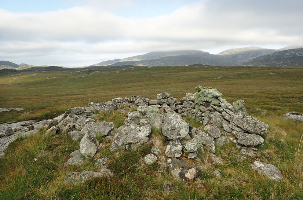
Beehive cell on Ascleit (2018)
I had easily found the Ascliet cells on a walk in 2018 (see the September 7, 2017 post). But the cell MacDonald mentioned on Beinn a’ Bhoth was a complete mystery. Beinn a’ Bhoth (the mountain of the beehive) is 1000 feet high, and spans over two-square miles. The CANMORE database does not show any sites on the hill. Neither does the 1854 OS map, which is usually a good source to find ruins. 

I knew I would not have the energy to walk over every square foot of the hill, especially after the long trek in, so I spent some time looking at the aerial photography overlays available on CANMORE. In scanning the images I noticed what looked like a small pimple high on the hill—possibly a beehive cell. During the walk described in the above referenced post I had passed right below it. In addition, I also noticed what appeared to be an intact cell at Griosamul, a mile east of the hill. And so a return to Beinn a’ Bhoth became a must. It would require a round-trip walk of 12 miles from Kinlochrog. A bit far for a day-trip, so I decided to make it an overnighter. 


I was on familiar territory as I headed south along the track to Morsgail Lodge, crossed the footbridge just before the lodge, and then traversed down the eastern shore of Loch Morsgail. At the Beinn na Gile beehives I turned southeast to follow a very old track up to the saddle between the summits of Shèlibridh and Cleit Shèlibridh. From the top I had a clear view south to Beinn a' Bhoth.

Beinn a' Bhoth (at centre) seen from Shelibridh
From Shèlibridh an easy descent south took me to the shielings of Airigh an-t-Sluic. This was where I would camp for the night in a few hours. To lighten my load for the rest of the day’s hiking I dropped my tent and sleeping bag next to one of the ruined shielings. Looming above me was Beinn a’ Bhoth, the mountain of the beehive.

The north and west sides of Beinn a’ Bhoth are a mix of steep, grassy slopes and craggy cliffs. I entered the grid coordinates into my GPS of the object on the aerial photo, and let the GPS guide me to it. As I climbed a grand view west to Loch Reasort and the Atlantic gradually opened up. When the GPS indicated I had 100 feet to go, I saw something, and gasped. Lying half enveloped in heather, moss and grass, stood a very old beehive. (Sorry, but I am not going to include a photo. I am saving it for a book on the beehive cells of the Hebrides, which I hope to get published later this year.)

The view west from Beinn a' Bhoth to Loch Reasort and Scarp
The cell had a spectacular view west to Loch Reasort and the Atlantic, with the island of Scarp on the far horizon. A more perfect place to spy on unwanted arrivals by sea would be hard to find. I regretted leaving my tent at Airigh an t-Sluic, as this would have been a memorable place to camp. But it was for the better, as the severe winds I experienced that night would have been much stronger at this elevation.

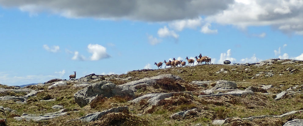
The sun relentlessly blazed down as I left the cell to spiral up to the summit. A joyful surprise startled me when I crested a small rise. On its far side was a large pond; in it a dozen deer lazily enjoying a cool soak. When they noticed me they jumped up in unison, causing sprays of water to erupt into the air. Then they elegantly sprinted away at breakneck speed. Within five seconds the only sign of their presence were ripples of water slowly spreading across the surface of the pond. By the time I got the camera out they had reached the ridge top above me.


Look north from the summit of Beinn a' Bhoth
I took some time to enjoy the 360-degree view from the summit of Beinn a’ Bhoth, then headed down its grassy eastern slopes. It was a 300-foot drop to the boggy floor of Gleann a’ Ghàraidh (they are all boggy), where I forded the Abhainn Gleann a’ Ghàraidh. As I ascended the hillside east of the stream a shout of joy burst forth—which scared a snoozing grouse out of the heather. At the shieling settlement known as Griosamul stood a compact triple beehive cluster, one of the cells 100% intact. It was the other cell I'd seen on the aerial photo, marked on the map as Both a’ Ghriosamul.

There were once three beehives clustered close together atop a mound at the center of the site, two of them interconnected. Only one of the three stands complete, and it is one of the best intact cells anywhere. After crawling inside I could see that the only large gaps in its dome were the smokehole at the top, and a small window to let the occupants keep an eye on what’s going on down in the glen. Having a window opening is unusual, the only other cells I know of with windows are St Ronan’s Cell and one of the beehives at Gearraidh Aineabhal. Inside the cell lay an old whisky bottle - unfortunately it was empty.

Inside the cell - Both a' Ghriosamul

Looking north over the cell at Griosamul
I am glad the users of this shieling site left one of the cells intact, for there was no mystery as to where the stones of the other cells had gone. At the base of the mound stood the ruin of a newer, oval shieling hut, obviously made from the pillaged stones of the other cells. And 100 feet to the north lay the foundation of another beehive almost completely plundered for its stone.

After leaving a note for the next visitor I crawled out of the cell, and then made a level crossing of the wide glen back to the shielings at Airigh an t-Sluic, where I’d stashed the tent and sleeping bag three hours earlier. As the sun started dipping west I pitched the tent by the meager remnants of a shieling hut. I fell asleep atop the sleeping bag in the hot, sun-baked tent, only to wake shivering at midnight as a storm blew through.


Lashing rain and howling winds came and went all night. In the morning I put off getting up as long as possible, hoping the rain would stop. But it didn’t. It was only after rolling up the wet tent, and strapping it to my pack, that the rain decided to stop. It was time to return to Morsgail, but only after making one more stop.

I headed to the northwest over a mist-shrouded ridge to find one of the old paths that lead north to Morsgail. These old, mostly abandoned paths are more interesting to follow than the muddy, quad-bike tracks that scar the moorland. Here and there these older routes cross substantial, and in some cases elegant, stone-slab bridges built in the early years of the estate. After crossing one of those bridges I came to a large, sunken, brown swath of moorland, 600 feet long and 200 wide, that marks the site of a vanished loch.

What's left of Loch nan Learga
Here I stopped to gaze skyward, hoping that a flaming interplanetary traveller would not plunge down on me. For it’s said a meteorite destroyed the loch that once lay here. In 1959 the missing loch, Loch nan Learga, collapsed in what is known as a peat slide, or bog burst. Its water draining into nearby Loch Mòr Shèlibridh. But what triggered it? It was possibly heavy rainfall, but at the Aird Uig radar base, twenty kilometres northwest of the loch, a giant “burning ball of hell” reportedly flew overhead. An expedition to the area discovered that the loch had drained. But there was no sign of any meteoritic debris.
The vanished loch and the final Postman's Stone
Fortunately, no meteorites plunged down on me as I carried on across the bog—talk about going out in a blaze of glory—oh, to think how the books would sell after that!  Near the vanished loch a pillar-stone stands atop a large mound, visible for quite a distance. It is a significant stone, a guide-stone, the last of the Postman’s Stones that lead you across the bogs from Kinresort to Morsgail. From there it was an easy trek back to the Beinn na Gile beehives, and then on to the quiet road at Kinlochrog.

Friday, May 31, 2019

Another One-Night Shieling - Fidigidh

In the July 28, 2017 post I described a miserable night I spent sheltered in an old shieling at Uishal on the north end of Lewis. Two weeks ago I spent another night in a shieling, but this time it was under far better circumstances.

I was on Lewis again, hiking through the Ardveg and Hamnaway areas of Uig. It was perfect hiking weather: sunny and dry, with a cold wind to cool me off and keep the midges away. One of the places I wanted to camp was Fidigidh; a shieling site used up until WWII by the people of Breanis, five miles to the west. At Fidigidh you'll find a handful of beehive cells, along with several 'newer' rectangular shielings.


I found a good spot near the beehive cell in the previous photo to pitch the tent. And as I started to do that the wind picked up significantly. The tent was flapping wildly as I attempted to lay it flat on the ground, and so I decided it was time for Plan B. 

Plan B was to make use of the roofless shieling hut nearby, which you can see in the background of the photo. The shieling would protect me from the wind, and so I went to take a look. There was enough space inside to pitch the tent, and the ground was flat. That was the good news. The bad news was the dead sheep inside - a very dead sheep: a skeleton resting on gobs of decaying fleece. 

After putting on gloves I started tossing bones and bits of fleece over the walls. Most of the fleece was carried aloft on the wind, and for a while it looked like a snowstorm had hit Fidigidh. In a half hour the shieling had been cleared out, the tent was in place, and this tired hiker was ready for bed.


It was the perfect one-night shieling. I had a lot more room in the tent than usual. I was able to use the fireplace, and several of the stone cupboards built into the walls, to store my pack, boots, and other gear that I would normally have to leave in the tent overnight to protect them from rain and the morning dew.


The only downside was that I had no view while laying in the tent. But all I had to do was stand and look over the shieling walls, where I had my choice of several vast panoramas: south to the hills of Harris, west to the Uig Alps, or north to the high hills of Beinn a' Deas and Beinn Mheadhanach. It rained that night, along with strong winds that would have kept me awake, and put my tent to the test, if I'd pitched it on the open moorland. And so I slept soundly that night, snug as a bug in a rug, in my shieling of the one-night.

Sunday, May 26, 2019

Mealasta Island

Two weeks ago I finally made it to Mealasta Island. Mealasta lies off the southwest corner of Lewis, three miles north of Scarp. I have sailed past Mealasta many times over the years, but the sea and wind conditions were never right for landing. Getting to the island was made possible by a chain of events that started with a walk I made two years ago to Fidigidh, a remote sheiling site on Lewis. Fidigidh has one of the most impressive beehive cells in the islands, and when I entered the cell I found a travelling book of poetry. (The story of finding the book can be found on the Bothy of Poems post from December of 2017).


In 2018, a year after finding the book, my wife and I met Sarah Wilson of Brenais (Uig), who had left the book in the beehive cell in 2016. Sarah also introduced us to Ian Buchanan, who lives in Breanis, and has a boat he regularly takes out into the waters near Mealasta Island. I mentioned my many failed attempts to get to the island, and Sarah and Ian extended an invitation to take me there the next time I was in the area. And so it was that on May 16 of this year, Ian ferried Sarah and myself over to elusive Mealasta Island.

Mealasta Island
Mealasta Island seen from Lewis
From the slipway at the end of the Uig road we motored across the half-mile wide Caolas an Eilean, which separate Mealasta from mainland Lewis. The best landing spot on Mealasta is at Craos, a small lagoon on the northwest corner of the island. The entrance to the lagoon is guarded by reefs, with a gap just wide enough to let in a shallow-draft boat.

The narrow entrance to the lagoon
We made landfall on the beautiful beach that lies at the head of the lagoon. Above the beach is Airighean a Chraos (Croas Shielings), where the only known dwellings on the island once stood.


I searched for the four ruins shown on the 1854 map. All I found were two vague rectangular outlines of stone, and the slight ruin of a shelter built against an outcropping of rock. I wonder if these had been the homes of the Mealasta people who were murdered for their cargo of timber at Bagh Ciarach on the east side of Lewis - a story usually referred to as the Pairc Murders. Although I am not sure if the victims were from the island, or from the Mealasta settlement opposite the island on Lewis. See the August 1, 2017 post for the story of the Pairc Murders.

The sparse remnants of a dwelling
From the old settlement site Sarah headed south to look for a spot to mount an otter trail cam, while I made a long wander around, and over the top, of the island. Here are a few photos from an enchanting day on an enchanting Island covered with primroses and sea campion.

Looking to Scarp from the northwest corner of Mealasta

Craos Beach (landing place) seen from above

Looking to Huisinis and Scarp (at far right) from the north summit
The skinny beach at Laimhraig an Seoraid (landing place of primroses)
Looking to Lewis and the hills of Harris from the south summit

The Uig hills seen from Traigh Mhor

Traigh Mhor

Craos Beach
Return to Lewis - the slipway at Road's End
It was a real privilege to spend six hours on Mealasta - an island I have wanted to see since I first laid eyes on it from afar in 2001 (see Book 2, Chapter 21).  Many thanks to Sarah and Ian for the opportunity.

Sunday, May 5, 2019

Sgurr Views

One of my favorite vantage points in the Hebrides is the top of An Sgurr on the island of Eigg—an iconic landmark for all who sail through these waters. Whether you are on a boat, or a nearby island, it is quite satisfying to know you've stood atop that dramatic peak when you see it from a distance.


I have climbed An Sgurr a few times over the years; the most memorable during an ice-storm in 2006. The next photo shows what the Sgurr looked like before I climbed it that time. Not very inviting—but I went up anyway.


I am so glad I decided to carry on to the top. Although the weather was awful, it cleared up every now and then, offering amazing views over the highlands of Eigg and the surrounding isles. In no particular order here is a selection of views I've seen over the years from the slopes, and the summit, of the Sgurr of Eigg.


The final shot is my favorite. It shows the mountains of Mordor (Rum) in the distance. Tolkien is said to have based Mordor on a view like this seen from the house of Howlin, three miles north of the Sgurr. If you ever have the chance visit Eigg, be sure to make the climb to the top of the Sgurr. 


PS: I will be off line for a few weeks, wandering somewhere in the hills of Morsgail, Uig, and Harris.

Thursday, April 25, 2019

A View to Scarp - and Others

Sometimes you stumble upon something special, something you've never heard of. This happened to me in the August of 2017, when I was driving to the road end in Mealasta, on the southwest coast of Lewis. As I neared the end of the road my attention was drawn to the amazing view south to Mealasta Island and Scarp. But even so, I did notice something unusual set between the road and the sea. It looked like a stone circle.


I parked the car, then made my way down the hillside to see what it was. It turned out to be a very unique view-indicator. The circle was comprised of eleven boulders, each with an embedded metal plaque that listed the place the boulder pointed to, and the distance to it. There are four island-stones, the south-most pointing the way to Scarp, just 5 miles to away. So close - yet so hard to get to.

The Scarp Stone

The four other island-stones point the way to Geisgeir, the Monachs, St Kilda, and the Flannans.


There are also three hill-stones that point to the nearby summits of Mealasbhal, Griomabhal, and Tamanasbhal. The final three stones point to some very far-off places: Nova Scotia, New Zealand, and the North Pole. If you ever make the drive to road's end at Mealasta, be sure to pay a visit to this impressive view indicator. It is a great place to go and dream of visiting the special places marked by the stones. I have been to about half of them, and someday I hope to get to the others - well, maybe not the North Pole.

New Zealand - 11,288 miles

Tuesday, April 16, 2019

Beehive Butts

Regular readers of this blog will be aware I am fascinated by the old beehive dwellings. I am always on the lookout for these cells, and on two occasions became very excited when I saw what, from a distance, appeared to be beehives. But on closer examination they turned out to be something completely different. Here is the first one, which I came across on a cruise through the Orkneys in 2014.


This thing sure looked like a beehive cell. And there was not just one, but three identical cells like this in a row. They were set above a narrow bit of land between the shore and a small pond on the west side of Copinsay.


I would later learn that these little cells were wildfowl shooting butts. The backside of the cells overlooked the fresh-water pond, and there were openings to shoot through. Many unsuspecting ducks came to an untimely end here, ambushed from these beehive butts.  


The second time I was fooled was in the moorland above Hamnavay, on the island of Lewis. I was hiking in to Fidigidh, which has one of the largest collection of beehive cells in the Hebrides. As I traversed the terrain north of the Hamnavay River I spotted, from a distance, what looked like several beehives in a spot I'd not heard had cells. Thinking I'd made quite a discovery, I excitedly made my way to them.


But as I got to the cells it was apparent they were not beehives. There were several similar structures, all with rounded ends and lots of open interior space. Based on the photos, what do you think they are?


As it turns out, they were grouse-butts. A place to lay in wait and ambush unsuspecting grouse. I have never had grouse, so I've no idea what it tastes like. Here is one description I came across:

The breast is beautifully tender, rich and scented with the most delicate of gamey tangs. There's a whisper of depth, sure, and in the legs a more pronounced kick, but nothing to frighten even the most timid of palates.

My palate has never been too appreciative of gamey tangs, no matter how delicate. But it would probably be splendid washed down with a dram of Famous Grouse.

Wednesday, April 10, 2019

An Island Dun

Sometimes when you're out for an island hike you encounter a surprise. A few years ago I made a circular walk on North Uist to see the souterrain of Taigh Talamhant (see the May 21, 2015 post). On the way back to the road I came across this amazing island fort in Loch na Caigainn, reached by a causeway. 


It was exciting to step across the causeway and enter the dun. It was a well defended in its day, with two flanking wings (walls) protecting the entry to the fort. Erskine Beveridge wrote about the fort in his epic book North Uist (1911). In it he mentions there was a Clach Ghlagain (rattle stone) in the causeway, that clanked loudly when stepped on to warn the dun-dwellers that someone was approaching. It was hard to tell which stone it was, because pretty much every stone clanked when I stepped on it.

Looking back to the mainland