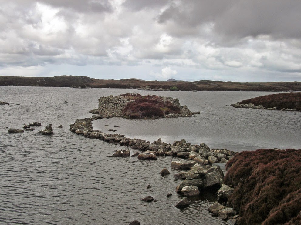
A walk on North Uist, one I've wanted to do for a long time, is the circumnavigation of South Lee. About 10 years ago I made a long out-and-back day-trip to see the causewayed duns of Loch Hunder, which lie on the west side of South Lee. But there is another old fort, Dun Caragarry, high up on South Lee, that I did not have time to see. And so I decided next time I was on Uist I'd do a two-day hike around South Lee. I'd revisit the duns of Loch Hunder, see Dun Caragarry, and then walk along the north shore of Loch Euphort to find a campsite on the coast.
It's a long walk from the road to Loch Hunder, about three miles of rolling, soggy bog. With a full pack on, if I wasn't careful, a misstep meant sinking to my knees in muck. It took nearly two hours to reach Loch Hunder.
 |
| One of the duns in Loch Hunder |
From Loch Hunder I was walking in totally new territory (for me). I reached the shore of Loch Euphort at Aird Bheag, and then followed it east to its narrow entrance from the Minch.
 |
| Eaval seen from the north shore of Loch Euphort |
 |
| The narrow entrance from the Minch to Loch Euphort |
Then it was time to climb, some 250 feet, up the shoulder of South Lee. There I came to Dun Caragarry. A dun that, at some point in time, someone built a beehive cell atop from some of the tumbled stones. The
CANMORE page on the dun says the dome of the cell is intact, but it has collapsed since they visited it in 1965.
 |
| Dun Caragarry |
 |
| Dun Caragarry - what's left of the beehive |
From Dun Caragarry I descended east to the sea, and then followed the coast north looking for a good campsite. The wind was howling from the east, so a few great campsites I found at the beach of Mol Teiltein had to be bypassed, as they were too exposed. Then I came to a narrow inlet by a headland called An t-Aigeach. It was very sheltered, and at its head was a little beach where I decided to pitch the tent.
 |
| Home sweet home |
Although it had been blowing, there'd not been a drop of rain all day. But just as I set up the tent the rain started to fall. It did not stop for 14 hours, and I spent all evening and night hunkered down in the tent. Fortunately I was so tired from the hike that I managed to sleep through most of it. The rain stopped at 7am, I packed up, and set out to the west to climb the pass between North and South Lee.
The pass was deceptive. From a distance it looked like there was an old peat track that would make for an easy hike (next photo).
 |
| Looking up the east side of the pass |
But on closer inspection it was not a track. It was a giant bank of heather covered peat, with swampy ground on either side. I had no choice but to follow it to the top of the pass to Loch Lee. From there a similar peat bank dropped down the west side of the pass to the vast moor I'd crossed the day before.
 |
| The west side of the pass |
Although I was a long walk away from 'civilization', the town of Lochmaddy was only a mile away across Loch nam Madadh. I was fortunate, in that the sun was out and there was no rain, and I had a brilliant walk back to the road. My wife picked me up, and then we had fish & chips at the Lochmaddy Hotel, some of the best we've ever had.
 |
| Lochmaddy seen from the moorland below North Lee |
Before we headed up to Lewis there was one more walk I wanted to do on North Uist; I wanted to climb Eaval. I'd started to climb it on an August afternoon two years ago, but I ran short of time and had to turn back. Eaval would definitely be climbed this time, and even better was that I was going to climb it with Martin Margulies. Martin wrote the book
Mhor and More about his many walks on the Uists. I was looking forward to meeting him and ascending Eaval.


No comments:
Post a Comment