
In the last episode we spent a windy night in a small tent atop Cleit nam Bothan Aird, the rocky eminence of the high bothies (beehive cells).

Bothan Aird lies a mile east of the head of Loch Hamnavay. Unless you have a friend with a boat, it is a 12 mile walk to get there via the Hamnavay track, or an 8-mile bog-slog from Morsgail. The previous day I'd made the 12-mile hike via the track, a walk I did not want to repeat, so the plan was to end the hike by heading east to Morsgail over the next two days.
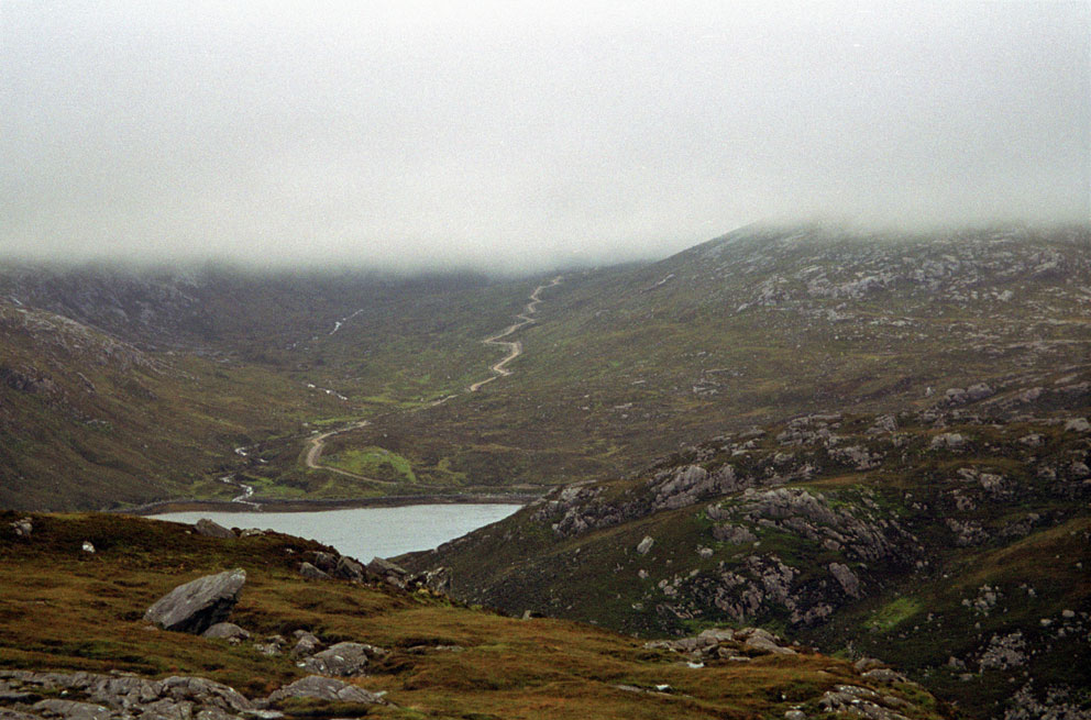 |
| Where the Hamnavay Track reaches the sea |

Although it had been a windy night, I was lucky, as it had not rained. So after a bit of a lay-in I packed up my gear, and after strapping the tent to the pack set out to the north.

Re-energized after the night's sleep, it was an easy hike down into the glen between lochs Gruinebhat and Bodabhat.
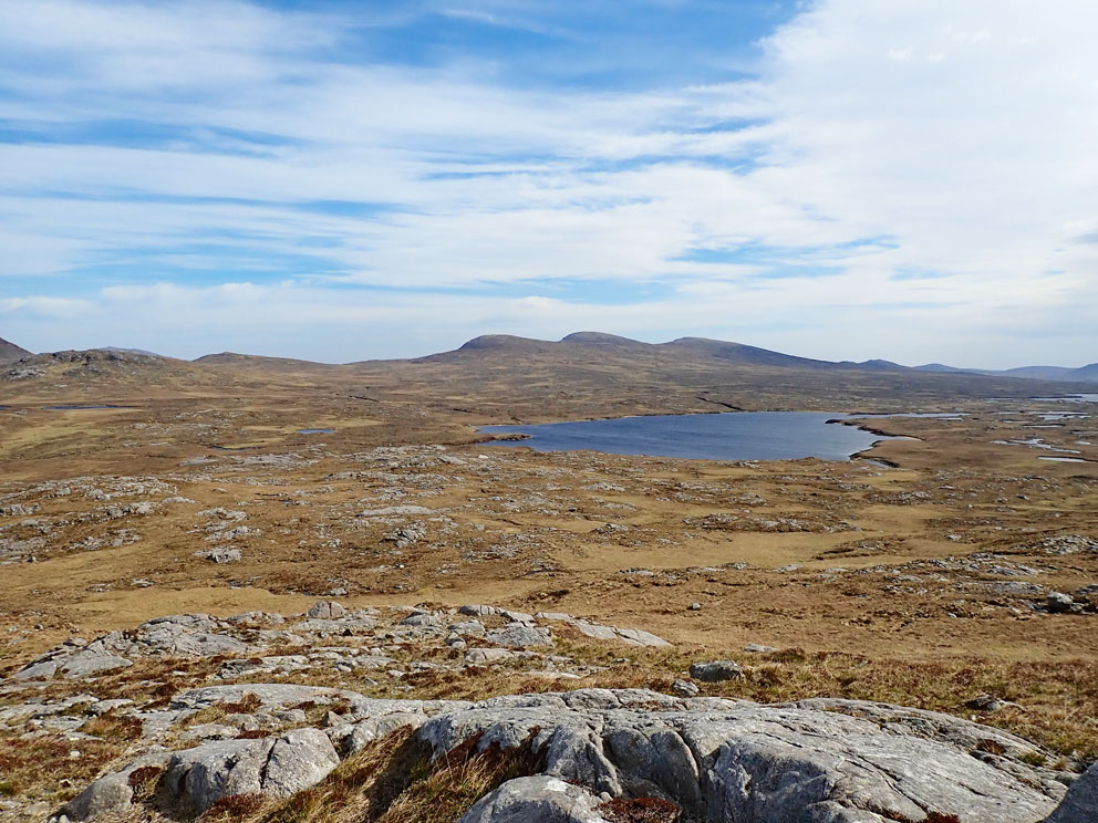
Then I started north up the pass between the two summits of Aineabhal (the notch you can see at the upper left in the next photo). Visible in the foreground of the photo is the stump of a WWI telegraph pole. A series of them once crossed the moorland from Hamnavay to Kinresort and Morsgail.

After descending from the north side of the pass I came to the shielings of Gearraidh Aineabhal. There are three of them: Gearraidh a' Stigh Aineabhal, Gearraidh Meadhonach Aineabhal, and Gearraidh a' Muigh Aineabhal (Inner, Middle, and Outer Aineabhal). The shielings were all placed such that the residents could see the head of Loch Hamnavay, a mile to the west.

In total, between the three sites, there were ten shieling huts, including three beehive cells. I always like to crawl into these beautiful structures and, if there are no midges, take a short snooze. It was too cold for the midges, so I had a brief nap.

From Aineabhal it only took 15 minutes to descend down to the Hamnavay River. I was a bit concerned that I might not be able to cross the river, which would mean having to walk a mile west to the bridge near the lodge. But the river was low, and there were several spots where it would be easy to ford. As it turned out there was no need to ford, because I was able to use a board that spanned one of the salmon weirs as a bridge.

Once over the river I turned east to follow the fisherman's path to Loch na Craobhaig. Portions of the path have wood planks that make the going easier across the soggy moorland. Although many of the planks are rotted, they still speed your progress east.

At a point just west of Loch na Craobhaig (the bushy loch) I turned north towards Fidigidh. Here there are several 'false' beehive cells, the grouse shooting butts I described in the April 16th post.

I was now in Fidigidh, and as I made my way north I took a look at each of the many shielings of Fidigidh Iochdrach (Lower Fidigidh) and Fidigidh Uachdrach (Upper Fidigidh). At Upper Fidigidh my quaking legs told me it was time for a very long break, say eight hours or so. The time had come to set up camp. (See the May 31st post where I described how the wind made setting up the tent difficult, and how I ended up pitching it inside a roofless shieling.)

Sunset on that May evening was at 10 pm, and it was still bright at midnight when I got up to take care of some urgent business. The wind died out around 3 am, and I had a lazy lie-in, stepping put of the tent at 8 am to find a calm, sunny morning. I would have an easy day ahead of me, as the road at Kinlochrog, where my wife was going to pick me up, was only six miles to the northeast. Along the way I would visit several of the shielings that dot the moorland near Loch Cro Chriosdaig, the loch of the Christian enclosure. A name that implies there was once a monastic settlement in the area.
After breaking camp I set out to the east with the sunlight for my load (and the full pack). You have to pay attention to every footstep as you cross this boggy terrain, which was very hard to do. The reason was I was distracted by an amazing sight: the stunning views across the loch-studded moorland to the high hills of Harris.

No comments:
Post a Comment