Saturday, December 12, 2020

Please, Sir, Can I have some more?

More breakfast fun in Scotland . . . 

On our first visit to Scotland my wife and I took my parents with us. It was 1989, and after exploring the Loch Lomond area we drove north to Fort Willian. As we approached the town we saw a vacancy sign at the Innseagan Hotel, and decided to spend the night there. We enjoyed a quiet evening, and in the morning the four of us went down for breakfast. As usual, there was a table filled with an assortment of cereals, and another table with a tray of tiny glasses set next to pitchers of apple and orange juice.

I proceeded to scoop some corn flakes into a bowl, and to fill one of those tiny glasses with orange juice. As I made my way to a table I heard a shout.

"Sir . . . Sir . . ."

"Yes", I replied.

"Please, Sir. You can have cereal, or juice, but not both." I had to return the juice. That was my introduction, and a still lingering memory, of Fort William. Good times.

Thursday, December 3, 2020

A Breakfast Request

A Scalpay week. Sounds fascinating, doesn’t it. A week in a Gaelic speaking B&B sounded even more fascinating. A chance to practice a language I’d been studying for a few years. I also had some unfinished business on Harris: a minor island easily reached from Scalpay by a bridge. And so I booked a week-long stay on Scalpay in the best time of year to do that, late spring. 

On the first day I made the circular walk to the Scalpay lighthouse, and was late getting back to the B&B. I was the only one staying there, and as I climbed the stairs to the room my host Annabel asked what I’d like for breakfast. I tried to say what I wanted in Gaelic, and as I did she nearly gasped, a look of puzzlement on her face; it was as if I’d asked for fried cow-pooh and boiled bull testicles (maybe I did.) 

I repeated my request in English: I'd like a bowl of corn flakes, two fried eggs, toast and coffee. She was still puzzled, a puzzlement that puzzled me for a few puzzling seconds. Then I realized most Americans want the full Scottish breakfast: porridge, eggs, bacon, sausage, beans, potato scones, tomato, mushrooms, kippers, and black pudding (I felt my arteries harden as I wrote that). Such a breakfast would leave me incapable of doing anything but having a heart attack, and then resting in peace, forever. She was very happy with my selection. It meant she did not have to get up at 4am to start cooking.


Tuesday, November 24, 2020

Tobar Odhran and an Image of Sloth

Over a year has passed since my last visit to the Hebrides, and another may pass before I return. I have spent some of the year writing, but most of it relaxing on my recliner. And as I do so I am the perfect image of sloth. 

Would an image of sloth be worthy of a statue? I hope so. I can see myself being immortalized in stone; resting comfortably in front of the TV, a beer in one hand, a remote in the other. I wonder if I can find an artesian with the skill of Michelangelo to chisel my lazy image in stone. Probably not. But someone centuries ago did immortalize two images of sloth in the Hebrides. They are known as Dealbh na Leisg, which can translate as either the image of laziness, or the image of sloth. Sloth, laziness, either would be appropriate for how I’ve spent much of 2020.

But I have to say my form of laziness is not quite like that depicted on these stones (not for many years, anyway). One of them is mounted high on the tower of Rodel Church on Harris. It shows a man laying on his back, passing the time, not with a beer in hand, but grasping his manhood. In the nineteenth century the Countess of Dunmore, not caring for the explicit nature of the stone, had it used for target practice. As a result the three-dimensional aspect of the stone has been, shall we say, circumcised. The stone is an odd thing to find on a church, but not this church. Just around the corner is the carving of a naked woman.

The second carving of sloth is on the island of Colonsay. It is a stone pillar that dates to the 8th century. Originally placed next to the chapel of Riasg Buidhe, a village abandoned after WWI, it was moved to Colonsay House garden in the 1890s.  The carving on the front of the stone is exquisite: at the top is the face of a monk, whose body is created by whirling designs similar to the rock art of Dalraida, terminating in what looks like a fish tail. The end result is an enigmatic fish-cross crowned by the head of a bearded monk.

The front of the stone is shown in countless books on the sculpture of the Hebrides. What’s never shown is the back side. That’s not just because of the subject, but also because the image is so worn it does not show up well in photography.

At first glance, aside from a lozenge shaped object near its rounded tip, the back of the cross appears undecorated. But there is a faded image, perhaps purposely worn off; one hinted at by its name, Dealbh na Leisg, the image of sloth. The subject of the decoration is further hinted at in this excerpt from Kevin Byrne’s book Lonely Colonsay; Isle at the Edge: “The reverse seems to be associated with a more virile tradition, possibly a symbol of fertility or potency.” Byrne goes on to quote a writer from the 1880s, who slyly remarked that “the stone is dressed only in front, undressed on the back.” This bit of undressed stone is a phallic symbol. A mixture of Christian on one side, pagan on the other. You can see a line drawing of the stone at this CANMORE link.

I wanted to see this unusual stone up close. So on a visit to Colonsay long ago I made my way to the garden. Looking over the garden wall I could see the stone, twenty feet away, standing watch over Tobar Odhran, St Oran’s Well. The holy well is covered by an old millstone, and if you lift it (which I did not do) you will discover the well is constructed of coursed and mortared rubble masonry, with steps leading three-feet down to the water. Set in the eye of the millstone cover is something odd. It may have been part of the axle for the millstone, but to me it looked like one of the pre-Christian water-worn bodach and cailleach stones, such as those found on Gigha and in Glen Lyon.

St Oran’s Well, in its garden setting under the watchful eye of the monk-stone, is one of the sacred sites of the Hebrides. I am no expert in what defines a thin place, where the border between this life and the next mingle; but whoever placed the stone here created a divine space: the cross with the face of a monk watching over the well, while the powerful image of Dealbh na Leisg wards off those who might not be intimidated by a cross; an example of a merged Christian and pagan talisman, all the protective bases covered in case one fails the test.  Maybe. Perhaps. Read into it what you will. 

Even though thirty years have passed, the fragrances of the Colonsay gardens pop into my head whenever I think back to the day I hopped over the garden wall (shame on me) to see Dealbh na Leisg. I will surely return to the isles of the west, but right now I’m going to recline in my chair, grasp something with one hand, a beer, and with a remote in the other see what’s on.

Thursday, November 12, 2020

Crògary Mòr and the Cave of Gold - North Uist

The old peat track up Bealach Maari looked inviting. As I strolled up the track the sun blazed intensely down, and so I stopped to take my shirt off. After a minute of savouring the cooling air the midges found me. I put the shirt back on. My destination was the summit of Crògary Mòr, five miles east of Vallay Island. I had wanted to walk over to Vallay, but the tides were not right for a daytime return, so I decided to get a view of the island from the summit of Crògary Mòr; at 590 feet one of the highest hills in the area. I was also doing something I love to do on a walk, following in the footsteps of an author. Alasdair Alpin Macgregor climbed Crògary Mòr in the 1920s, and wrote the following:

Not a halt do I allow myself until my brogues are feeling the rocky summit of Crogary Mòr, and the eyes of me searching for the cave of gold reputed by the isles-folk to contain of precious metal the fill of seven cow’s hides . . . And I see, too, where the moors of Eaval appear to slip over the horizon into the great North Ford. And the Isle of Benbecula lies beyond, like a ruby set in a sea of glittering sapphire. 

Erskine Beveridge also wrote about the treasure of Crògary Mòr:

A tradition is locally current to the effect that one of the MacQueens of Oronsay buried a golden treasure in a foal’s skin near the summit of Crogary More at a spot from whence the sun can be seen shining upon three forts at the same time. These conditions infer a hiding-place on the north face of the hill, within view presumably of Dun na Mairbhe, Dun Aonghuis, and Dun Rosail.

Hmmm . . . A secret location where the sun can be seen simultaneously shining on three prehistoric forts. Exciting stuff. Like something out of an Indiana Jones movie. Hopefully there would not be any deadly booby-traps waiting to spring on someone unworthy of the treasure (like me). And as for that treasure, there is a bit of a discrepancy in the descriptions. Would the amount of gold fill the hide of one foal, or seven cows?  And what exactly is a ‘hide-full’ in the metric system?

Crogary Mor seen from Loch Aonghais

The top of the hill was a steep, bald hump of bedrock. As I climbed to the summit I kept an eye out for the cave of gold, but saw nothing. On reaching the top I took out a map to pinpoint exactly where the three forts were that Beveridge mentioned. The one known as Dun na Mairbhe, dun of the dead—a good name for a zombie movie—could be seen a mile to the north on an island in Vallaquie Strand. Also visible was Dun Aonghuis a mile to the northwest, and Dun Rosail, two miles to the northeast.

But no matter where I stood on the hill the sun was shining on all three forts. Perhaps Beveridge was thinking of the wrong three. The bottom line was that I had to give up my hunt for gold. So for all you treasure seekers there, start plotting the locations of the duns of North Uist, all five-hundred. Then see if you can figure out another three that are visible from one spot on Crògary Mòr.

What I could see from the summit was the isle-studded sea; Vallay, Oronsay, and myriad islands beyond, including St Kilda on the far horizon. 

Looking northwest from Crogary Mor

The hill known as Maari, nearly as high as Crògary Mòr, lay a half-mile to the west. The pass between the two hills is called Bealach Maari, and at its southern end is a seven-foot standing stone. The stone may be a boundary- or way-marker, but it could have other roots. I say that because on the western slopes of Blathaisbhal, two miles to the southeast, there are three other standing stones. This trio is set in a linear alignment that points directly to the stone in Bealach Maari. Perhaps all of them are markers left to guide someone who knows the secret to the cave of gold. 

Hopefully I’ve inspired you to search for the hidden gold of Crògary Mòr. If you find it, kindly forward me one cow’s hide worth as a commission for the idea.

Stone alignment at Blathaisbhal - the hills Maari and Crogary Mor in the distance

Wednesday, September 30, 2020

Cleit nam Bothan Aird

A full year has passed since my last trip to the islands. I hope it won't be that long before I get back. It is photos like the one below that keep me planning return trips; trips that will be better than ever. That's because looking at photos like this make me realize how complacent I'd become, taking for granted that every year I'd be able to throw a pack on my back and find an island campsite with views like this. 

The photo shows the view to the sea from the summit of Cleit nam Bothan Aird, which lies a mile east of the head of Loch Tealasbhaigh. The large loch in the foreground is Loch na Caillich. In the far distance is the island of Scarp, and off to its right end lies the little island of Cearstaigh. No one can look at a photo like that and not want to sit on that panoramic spot and watch as the sun sets over the sea between St Kilda and the Flannans. I will no longer take something like that for granted, and will treat the next time as if it was the last.

The view the other way was just as memorable: in the foreground is a splendid example of the beehive builder's art, with the high hills of Harris in the far distance.

Monday, September 7, 2020

A Building at Risk

Isn't this absolutely stunning?


I stumbled across this gorgeous beehive cell a year ago on a walk through the Hamnavay area of southwest Lewis. I had decided to visit this particular site because the 1854 OS map indicated it had a two roofed structures of some sort, drawn as squares, which later maps marked as "Old Shielings". Then, while perusing aerial photos of the site, I noticed that there were two small circular structures standing side by side, placed exactly where the old map showed the two square structures. I am always on the hunt for beehive cells, and "ruins" marked as "Old Shielings" occasionally indicate circular corbelled beehive structures, some much older than the shielings. 

Why the surveyors decided not to differentiate between circular cells and rectangular shielings on their maps is a mystery. It shows the sad lack of appreciation they had for the history of what they were surveying.

The above photo is deceptive. What it does not show is that the very top of the dome has collapsed. Over the next 20 years the rest of it will probably fall. Then this magnificent cell will then look like its neighbor, just ten feet away, whose dome has completely collapsed.


I crawled inside the beehive and tried to imaging what life would be like living in this beautiful cell, which lies a mile east of the head of Loch Hamnavay. These cells are ingeniously constructed, and in the following photo you can see where the vertical walls transition to the overlaying stones of the corbelled dome. At the lower right you can also see a tiny window opening - an unusual thing to find in a beehive.


The cell had a two doorways, one facing west with a view to Loch Reasort, the other facing up the glen to the northeast. Depending on the wind direction, one of the doors would be blocked to allow for comfortable ventilation, keeping enough smoke out to be breathable, and enough smoke in to repel the midges.


This cell was a real find, and nothing (that I can find, anyway) has ever been written about it. Over the past 170 years about 20 beehives in this general vicinity have been studied, drawn, and surveyed, but for some reason this one, and several others nearby, have been completely ignored. I describe my journeys to nearly a hundred cells in my third book, Journeys to the Beehive Cell Dwellings of the Hebrides, which will be published by Acair early next year.

Friday, August 28, 2020

An Irate Comment

I recently received an irate comment on an old post. It was a post that described my one, and only, visit to one of those small Hebridean islands whose owners consider it their private kingdom. That visit was back in 1998, and I was only able to find a boatman willing to take me there on a day when he knew the owners were off-island.

The essence of the comment was that I should provide them with my home address, so that they could tromp through my garden, peek into my windows, and then blog about it. Their anger was misplaced, as I did not walk through any gardens, and did not look into any windows. The landing place on the island is below the only house on the island, and I passed by it as fast as possible in order to gain access to the rest of the island. I did take photos of the house as I passed by, as it is quite a beautiful structure. I won't name the island here, but a search of old posts will easily identify it. The photo I am using in this post is from the main access point to Eilean Righ, another 'private island', but not the source of the comment.

I am well aware of the rudeness of so many tourists. A friend of mine runs a guest house near Eilean Donnan Castle, one of the most well known tourist destinations in Scotland. She has many tales of tourists peering in windows, and deciding to have picnics in her garden. So I completely understand the basis of the comment I received. I hope it made them feel better to lash out publicly, even if the target was misplaced.

There are five or six Scottish islands that I've discovered their 'owners' do not welcome uninvited (or non-paying) visitors, and consider their islands to be private kingdoms - the best known example of this was Rum back in the day. Not being a Scottish citizen, I don't feel comfortable commenting on "Right to Roam", and all its aspects, and responsibilities, on roamer and owner. But it eludes my why someone would buy property in Scotland who is not comfortable with the concept, and who would not find a way to make it work in their particular circumstances.

In designing cruise itineraries these days I avoid these five or six islands like the plague - not in deference to the owners, but because their thinking makes the islands sad places to visit, and there is a galaxy of other Scottish islands out there that like to be visited. In my roamings I have always tried to respect the privacy, and occupational needs of landowners, and given them as wide a berth as possible. But there are times when accessing an island means walking near a residence. So to the person who vented on me, I apologize for all the thoughtless visitors who peek in your windows and tromp through your gardens, but I had every right to seek out the historic sites on your beautiful island.

Wednesday, August 5, 2020

The Lost Summer of 2020

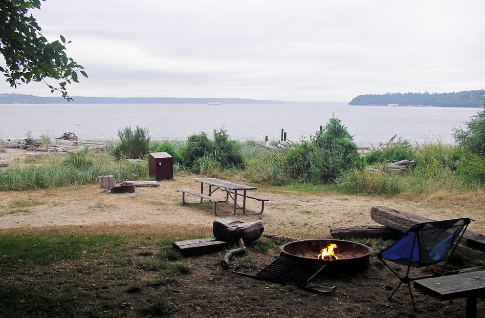
Here I am stuck stateside. I am so jealous, as I hear tales of friends in the UK actually being able to venture out to the isles. But for me that's a 50/50 hope for 2021. A couple of weeks ago I did manage to get to an island. Blake Island State Park is only five miles from my home in West Seattle. I camp there at least once a year, and a few weeks ago I went over for two nights. Because of Covid they were only offering weekend trips, so I had to put up with the typical Friday and Saturday night drunken yotties, who carry massive coolers of booze ashore and proceed to party the night away. Saturday night was the worse, and bizarre to say the least. The idiots insisted on playing the soundtrack of Sound of Music at 100 decibels. I guess it could have been worse . . . 

In pre-Covid times the island hosted a well know Native American experience, where they bake salmon on open cedar fires. In 1993 Bill Clinton hosted one of those dinners for those attending the APEC (Asian Pacific Economic Cooperation) conference in Seattle. But this year they've had to resort to offering a smaller dining experience. One benefit of this, to campers like me, is that they have a bar open to all comers. You have to imbibe outside in the sunshine, and I was able to have a couple pints of Manny's, my favourite Seattle beer.

Clinton & company in 1993

Quieter times


The island is full of raccoons - appropriately masked, I'm glad to report - and I had a good laugh when around 2am, just as the drunks had all passed out, the raccoons raided their campsite, devouring all the snacks they'd left out. One dimwit left their tent open and ran screaming into the darkness. I had to laugh again as a fearless raccoon scampered into it looking for a snack. (In the second photo below you can see the metal food lockers they provide to keep food from the critters, which my 'friends' in the adjacent campsite decided not to use.) Oh how I missed the silence of a campsite on the remote moorland of Lewis.

At daybreak, while the numpties were sleeping off their hangovers, it felt so good to make as much noise as possible as I cooked breakfast. It was only instant coffee and instant oatmeal, but it's amazing just how much noise you can make if you really try.


So that was my island adventure for 2020. Not much, but better than nothing, and I hope to get out for another camping expedition before the days start getting short. I also have some articles in the works for Scottish Islands Explorer, which should keep me out of trouble in the near term. The long term plan is to set foot on Mingulay in eight months, and then Sula Sgeir in ten months. Fingers crossed!

Wednesday, July 15, 2020

North Rona - A Year Later

Here I am spending my afternoons sitting on my deck, tossing peanuts to blue jays and squirrels. They are very happy I'm here, but I can't help looking back to where I was a year ago this week. I was on far off North Rona, on my fourth cruise as a guide on Hjalmar Bjorge. I was looking forward to seeing Rona again, as eight years had passed since my last visit in 2011.


After a walk to the lighthouse we explored the village ruins, a clusters of cells and rectangular structures built along the south side of the monastic cashel. 


At times, upwards of thirty people lived on Rona, surviving off the birds, seals, and the island’s seventeen arable acres. It was a hard life, and the entire population starved to death at least once. In the early 1800s only six acres were under cultivation, and the last permanent residents left in 1839.

The stellar attraction of the village is St Ronan’s Cell and Church. The cell dates to the seventh or eighth century; the church added to its west end in the thirteenth century. The only entrance to the cell is low in the east wall of the church. Several inches of muck usually cover the ground, and as the portal is only a metre high you have to squat down to enter. Once inside it is clear this is not an ordinary beehive. The high rectangular interior, similar to some of the large beehives on Skellig Michael, and one of the cells on the Flannans, signifies it as an oratory.


There are many other beehives on Rona, but aside from Ronan’s Cell they are in a very sorry state. There is also a rectangular structure called the Manse, adjacent to the cashel wall, built from the stones of a dozen beehives that once stood there. And just north of Ronan’s cell are two mounds that mark the sites of beehives cannibalized to build the church.


And so as I toss peanuts to the jays and squirrels in the summer of 2020, I dream of visiting Rona once again. I am signed onto Northern Lights Rona/Sula Sgeir cruise next June, and dearly hope I'll be allowed to visit the UK to set foot, once again, on far off Rona - and finally attempt a landing on Sula Sgeir of the gannets. Thinking positive, I've told the squirrels and jays they'll be on their own next summer. 

Saturday, July 4, 2020

Kerrera - A Year Ago

Here I am stuck at home, with a total incompetent in charge of things. It probably means the virus will run rampant for the rest of the year, and ten's of thousands of unnecessary deaths. It seems trivial, in all of this, that I am concerned about not being allowed to return to the UK in 2021. But those trips have become very important to me over the past 30 years.

At this point, the best island-going I can do is by living in the past. It was in July of last year that I visited a dozen Hebridean islands, starting with Kerrera. I took the relatively new north-end ferry, and then spent a couple hours wandering around the north tip of the island. After a visit to the Hutcheson Monument, and the nearby monastic ruins, I made my way to the shore opposite Rubha a' Cruidh (cattle point). That 'point' is actually a tidal island connected to Kerrera, from where they used to swim cattle to the mainland. It was low tide, which I'd assumed would allow for a dry-foot crossing. But my assumption was wrong. There was still a two-foot-deep channel. 


There were several large stepping stones, but they were rounded, spaced far apart, and far too slick to step on. It was as if the owners wanted the ambiance of stepping stones, but not ones that could actually be used. The new owners must be well off. No usable stepping stones are needed because they've built a hundred-foot pontoon dock, and installed a helipad next to the mansion.


The water was shallow enough to wade across, but I decided against it. It would be worth getting wet if I could wander freely around the island. But I could see that a gate barred access to the track on the far side, which leads to the mansion that was built on the islet several years ago. I got the definite feeling I would not receive a warm welcome. There were bound to be alarms, and Alsatians ready to eat me, so I decided not to spoil my brilliant day with an unpleasant encounter.


I have fond memories of Rubha a' Cruidh. Prior to the construction of the mansion there was a modest house on the island, which looked like a peaceful retreat from 'big city' Oban. I remember many cruises out of Oban, where the sight of that simple house signaled the beginning, and the end, of island adventures. Another memory was Samson, who stood guard on the shore of Rubha a' Cruidh for many years. He would bid us farewell as we departed, and greet us on our return - always ready to repel any unfriendly visitors.


Whoever built the new mansion must not have liked Samson. Either that, or the old owners of Rubha a' Cruidh wanted to keep him. When the mansion was built Samson disappeared, but a year later he made a brief appearance on Oban's North Pier. He was not there for long, and I've not seen him since.


I then made my way to the Marina to await the ferry back to Oban. I had a few minutes before it left, so I took a look at the Waypoint Restaurant. Unfortunately I did not have time for a pint. I promised myself I'd return someday for that pint, and boarded the ferry.

Next up would be a visit to one of my all-time favourte group of islands - the Shaints.

Tuesday, June 23, 2020

Yet Another Bell Stolen

I recently learned some sad news. Twenty years ago I visited a unique island in Loch Shiel, a dozen miles southwest of the Glenfinnan Monument. This small island has two names: An t-Eilean Uaine (the Green Isle), and Eilean Fhianain (St Finnan's Isle). I wrote about the visit in chapter 20 of book 1, and the highlight was seeing Clag Fhianain, a bronze handbell that has rested on the altar of Isle Finnan for several centuries. 


The sad news was that the bell was stolen from Eilean Fhianain in 2019. There is a scorching place in hell waiting for the thief, and he will have a lot of bell-thieving company. The loss of Clag Fhianain is just one in the long list of Celtic handbells that have been stole over the years. There is St Kenneth's Bell, taken from Inchkenneth in the late 1700s, St Kessog's Bell, which went missing from Loch Lomond in the 1800s, and St Modan's Bell last seen at Ardchattan. Prior to the loss of Finnan's Bell, the most recent theft was when St Adamnan's Bell was stolen from Insh Church in September of 2017. I visited Insh in 1995 to see the bell, and was surprised to find it mounted on the church wall, completely unattended.


Although there are curses, and legends, that these bells always find their way home, I don't have high hopes that they will be recovered. But, just perhaps, at some point in the future these low-life thieves will die an unpleasant death, and their families will discover the bells hidden in dusty closets and return them. That's what happened to the Clanranald Stone, stolen from Howmore on North Uist in 1990. Five years later the heavy stone was found in a London closet after the thief died. It is now back in the Western Isles where it belongs. One can hope a similar fate awaits the bells, and the thieves, of Isle Finnan and Insh.

Thursday, June 11, 2020

Dolphins at Play

Being stuck at home has one benefit. I have been able to make a start at organizing my camera memory card backups. I am always afraid I'll lose photos, so in some cases I've made backups of backups of backups. All resulting in terabytes of files scattered about in ten different external hard drives.

As I go through all these files I occasionally stumble upon videos, like the ones in the last few posts, that I'd totally forgotten about. I have taken very few videos over the years, as when I do I end up concentrating on the camera and not the moment. I was so excited when GoPros came out that I bought one in 2010. But it became just one more thing to pack and keep charged, so it only made its way to Scotland once. Since then what few videos I've taken were using my trusty point-and-shoot, so the quality is not too good.

Here is one of those point-and-shoot videos. It dates to 2009 and shows a half-dozen joyful dolphins riding the bow wave of Halmar Bjorge. These days when the dolphins show up (as they usually do) I leave the camera off and enjoy the show.


Wednesday, June 3, 2020

Don't Go On The 8-3-0

Since 1990, on my way to the isles, I must have driven the A830 highway from Fort William to Mallaig a dozen times. Prior to 2009 much of it was a terrifying single track, especially so for rookie left-side drivers. The road had narrow hairpin turns, and blind corners, where at any moment a large truck carrying fish or timber could appear out of nowhere coming head on. The danger was not just in front. A look in the rear-view mirror would usually show a gargantuan tour bus on its way to the Skye ferry. The bus would be so close that you could see the driver's agitated face in the mirror. The cause of the agitation was not the dangerous road, but how slow you've been driving.

If you've ever driven the road to the isles when it was single track there is a song guaranteed to make you smile. It is Don't Go On The 8-3-0, and can be found on the McCalmans 1993 album Honest Poverty. Have a listen - lyrics can be found at  Don't Go On The 8-3-0. My favorite bit is:

When lorries lose control, you've one last wish
Don't let me die under 20 tons of fish.

Friday, May 29, 2020

I Miss the Puffins, too

In a normal year several thousand tourists make day-trips from Oban and Mull to see the puffin colony on Lunga. When those trips are operating there can be close to a hundred people on the island, all wanting to get close to the colorful birds. It is exhilarating to sit next to the burrows and watch as the Puffins go about their business; and busy birds they are, continually flying in with beakfuls of eels to feed their young. Those not busy feeding spend their time bickering, kissing, and growling at each other. (The birds, not the tourists. Although I have seen a few growling tourists over the years). The puffins are used to visitors, but I am sure they are happy to be left alone this year.

The best way to avoid the crowds is on a small boat cruise, where they'll set you ashore before the day-boats arrive. The following video was taken in 2008, when I was on the sailing yacht Zuza. Including myself, there was a grand total of four passengers on the cruise. (It doesn't get much better than that.) This allowed us all to spend some quality time with the puffins. The video gives some sense of what that's like. (You can see Zuza in the background of the first scene).


Monday, May 25, 2020

I Miss This

I miss sitting atop the wheelhouse of Hjalmar Bjorge as it plows through the sea. Here's a sampler of what that's like. The final section show us in calmer seas off Sulasgier of the gannets.

Monday, May 18, 2020

Talisker House - A look Back

The last post on a virtual visit to the Viking Canal made me wish I was really on Skye. So I dug through my journals looking for entries about the island. As I did I came a cross a Skye walk I'd never written about - one made twenty years ago. 

It was June of 2000. After a long stay on Rum (book 1, chapter 28), my wife were on Skye, driving the single track to Talisker House. I'd booked a room there for one night to break up our journey to North Uist. Oh how I regret my thinking back then, in just booking for one night - one night in a historic place that deserved a week at least.

It was a beautiful, cloudless day, as we made the 50-mile drive across Skye from Armadale. We found Talisker House at the end of a long single-track road, where we were graciously greeted by Jon and Ros Wathen (I believe the Talisker Estate was owned by their family). We were fortunate in our timing. Talisker would not operate as a B&B for very long, as in a few years the Walthens would leave to run a guest house in Australia.


Talisker House was built in 1717 for the Macleods of Talisker, and hosted Boswell and Johnson for two nights in 1773. Dr Johnson did not think much of the place, reporting that it is The place beyond all that I have seen from which the gay and the jovial seem utterly excluded.

Talisker is an interesting name. So much so that the Carbost distillery, which lies four miles away on the shore of Loch Harport, took it as a name. I have come across two translations of Talisker. The first is 'house at the rock', the second is 'echo-rock' (the Gaelic for 'echo' is MacTalla, the son of the hall). The aforementioned rock is Preshal Mor, which you can see in the previous photo looming 1000 feet above the house.

We had booked for dinner at the house. That's something I don't usually like to do as it limits your options for a long walk. But there were no other places for a meal in the area. With only two hours to explore I decided to walk some of the Talisker Horseshoe and see if there was an echo at Echo Rock. 


The Talisker Horsehoe is a five mile circuit from the house up to Preshal More (1050 ft.), then around the upper reaches of Glen Sleadale to Preshal Beg (1130 ft), and then back down to Talisker. With only two hours I'd just have time to reach the head of the glen.

From Talisker House Preshal More looks like the Devil's Tower, a massive stack of rock. But as I climbed to the southeast it became a giant wall of stone that reminded me of the Sgurr of Eigg. As I approached I could hear the echos of baa'ing sheep.


It had been a long day of travel, and it was very hot. I was so tired after climbing 500 feet in the heat that I decided not to climb to the top. After finding a place to sit and catch my breath I started to yell, listening as the echos washed down into the glen.

I carried on south along the route of the horseshoe. An hour into the walk I came to the turnaround point at the head of Glen Sleadale. It was a beautiful spot, and in the late afternoon haze one of Macleod's Maidens could be seen rising from the sea off Idrigill Point.


If I hadn't had to be back by 7:30 I'd have kept on going. But the wife would not be very happy if I missed dinner, so I started back. The walk down the glen, along the banks of the Sleadale Burn, was stunning. And as I rounded a knoll the policies of Talisker House came into view, an oasis of pines surrounded by fields of abandoned lazybeds.


I was back just in time for dinner. I don't remember what was on the menu, but I do remember that my wife and I felt a little under-dressed in our jeans, as everyone else was smartly attired. But we travel light, and jeans are all we bring on vacation. After the 'Full Scottish' the next morning we set off to Uig to catch the ferry to Lochmaddy.  

I regret that all-too-short stay, and so a return to Talisker is high on the to-do list. But the closest I'll get this year is by enjoying a smoky dram with a splash of highland spring water. 

Slainte!


Saturday, May 9, 2020

The Viking Canal - A Virtual Visit

I'm still stuck in lockdown here in Seattle. Day 70 and counting. Virtual visits to the Hebrides are all that's possible. So I thought I'd go on one, and return to a place on Skye I've only visited once: Loch na-Airde and the Viking canal. Twenty years have passed since I was there. During those decades much has been discovered about the loch and its canal. The site is now thought to have been a medieval boatyard.


In 1995, six years before my visit, an underwater survey found several boat timbers lying in the silty bottom of the loch, but they were left in place. Further survey work in 2000, when the water level was unusually low, led to the discovery of an oak boat timber. Radiocarbon dated to 1100 AD, it is believed to come from a four-oared clinker built ship, twenty-feet long. A ship that size was too large for just using in the loch, it had been a sea-going vessel. 

In 2008, seven years after my visit, a larger piece of timber was found, most likely from a ship thirty-feet in length. Initially thought to be 12th century, it was radiocarbon dated to the 19th or early 20th century. Proof that the canal was in use for over 800 years.

Additional underwater surveys found remnants of a quay where the canal enters the loch. It spanned the entrance, with a gap in the middle. The gap allowed ships to pass, and may also have been part of the water management scheme for the loch. Loch na Airde is shallow, much of it only six-feet deep. Its primary source of water are the small streams flowing off the slopes of Carn Mòr, and from a small loch above the township of Dùnan, where the MacAskill of Rudha Dùnain lived. 

The mean elevation of the loch is only a few feet above sea level, so seawater can only get in at extremely high tides—tides in excess of +5 feet—so they had to control the water level to keep boats afloat at all levels of tide. Aside from the quay at the end of the canal, another mechanism to control the level appears to have been an adjustable dam built at its halfway point. A dam that could be temporarily removed to allow ships to pass at high tide. Note that this is speculation on my part; but the structure, whatever it was, can still be seen today. Blocking the central part of the canal, it is so tumbled that it looks like a pile of ruble.

It would of taken a lot of work to manage the water level of the loch, so it may have been done only a few times a year when bringing boats in for repair, launching newly built ones, and when over-wintering ships in the loch.


The time-line for this complex site would start with the establishment of the promontory fort 2500 years ago, a place of refuge for the settlements north of the headland. The fort had a navy of sorts, based in the two stone-lined boat noosts below the fort, where ships could be pulled out of the water.


Fifteen-hundred years later the Norse took over. They constructed the 200-foot long canal to the loch, creating a boatyard and safe-haven on Loch na Airde for over-wintering ships. Another 600 years pass, and the MacAskills establish the township of Dunan; building two dozen homes and cultivating crops in the surrounding terrain. The township was cleared in 1873, and the area has been deserted ever since.

Taken as a whole, Rudha an Dùnain is one of the premiere historic sites in the Hebrides. Fortunately it is difficult to visit, and so is protected from damage caused by thoughtless visitors. In a well deserved, and long overdue recognition, it was scheduled as a historic monument in 2017.

Oh how I wish I new all the above when I walked there in 2001, and so a return to Rudha an Dùnain is demanded; not just a virtual one, not just a day-hike, but to camp for the night.

I’ll come on a sunny, midge free day (I’m dreaming here, might as well be optimistic).
I’ll come on a day of high spring tides.
I’ll pitch the tent next to the fort overlooking the canal. 
I’ll watch as the flood tide surges through the canal.
I’ll imagine I was there 800 years ago, watching as galleys venture in and out of the loch.

Maybe, someday . . .   Now I just want a vaccine.

Friday, May 1, 2020

Make me Smile

We all need something to smile at right now. Here are some puffin pics from the Flannan Isles.